. . . your guide to visiting the holy places  
If you have found See the Holy Land helpful and would like to support our work, please make a secure donation.
The Sites

Israel and Palestine – In Jerusalem

Israel and Palestine – Outside Jerusalem

Jordan

Egypt

Extras

Monastery of St George

West Bank

Monastery of St George

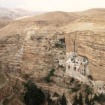
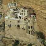
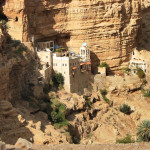
Monastery of St George in Wadi Qelt (Avishai Teicher / PikiWiki Israel)

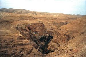
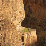
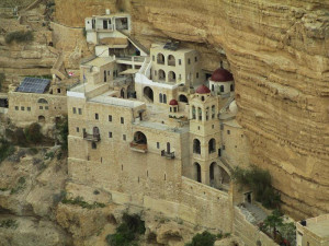
The spectacle of the Monastery of St George — a cliff-hanging complex carved into a sheer rock wall in the Judaean Desert, overlooking an unexpectedly lush garden with olive and cypress trees — is one of the most striking sights of the Holy Land.

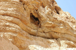
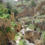
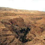
The monastery’s picturesque setting is in a deep and narrow gorge called Wadi Qelt, in a cliff face pocked with caves and recesses that have offered habitation to monks and hermits for many centuries.

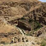
The wadi winds its deep and tortuous course for 35 kilometres between Jerusalem and Jericho — for most of the way providing a route for the Roman road on which Jesus set the parable of the Good Samaritan (Luke 10:25-37).

Some also envisage it as the “valley of the shadow of death” in Psalm 23.

Monastery of St George

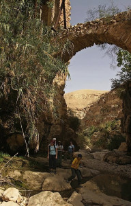
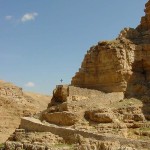
Wadi Qelt in Judaean Desert (Jerzy Strzelecki)

The monastery, founded in the 5th century, is about 9 kilometres from Jericho and about 20 kilometres from Jerusalem, and on a favourite trail for hikers.

It is well known for its hospitality and, unlike most Greek Orthodox monasteries, welcomes female pilgrims and visitors — following a precedent set when a Byzantine noblewoman claimed the Virgin Mary had directed her there for healing from an incurable illness.


St George came from Cyprus

The monastery was founded in the 5th century when John of Thebes, an Egyptian, drew together a cluster of five Syrian hermits who had settled around a cave where they believed the prophet Elijah was fed by ravens (1 Kings 17:5-6).

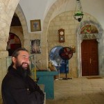
Monastery of St George

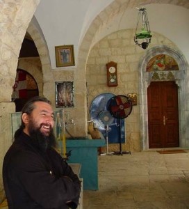
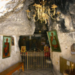
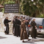
Hospitable Greek Orthodox monk at Monastery of St George (Don Schwager)

But it is named after its most famous monk, St George of Koziba, who came as a teenager from Cyprus to follow the ascetic life in the Holy Land in the 6th century, after both his parents died.

Another tradition links a large cave above the monastery with St Joachim, father of the Virgin Mary. He is said to have stopped to lament the barrenness of his wife, St Anne — until an angel arrived to tell him she would conceive.

The monastery went through the phases of destruction in the 7th century by the Persians (who martyred all 14 resident monks), rebuilding in the 12th century by the Crusaders, then disuse after the Crusaders were expelled from the Holy Land.

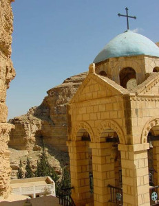
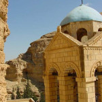
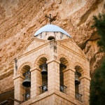
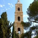
Complete restoration was undertaken by a Greek monk, Callinicos, between 1878 and 1901. The bell tower was added in 1952.

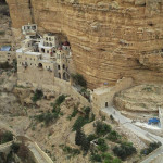
Monastery of St George

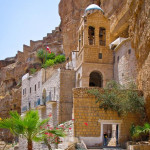
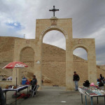
Bell tower at Monastery of St George (Don Schwager)

In 2010 a new road improved access, but visitors must walk down a steep and winding path for about 15 minutes (or hire a donkey from local Bedouin) to reach the monastery.

Just a handful of monks remain at St George’s, one of only five monasteries still functioning in the Judaean Desert.


Mosaic floor from 6th century

The three-level monastery complex encompasses two churches, the Church of the Holy Virgin and the Church of St George and St John. They contain a rich array of icons, paintings and mosaics.

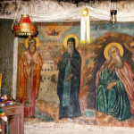
In the ornate Church of the Holy Virgin, the principal place of worship, a mosaic pavement depicts the Byzantine double-headed eagle in black, white and red. The royal doors in the centre of the relatively modern iconostasis date from the 12th century.

Monastery of St George

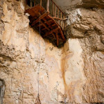
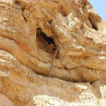
Precarious access to monk’s cave in Wadi Qelt (Sir Kiss)

The Church of St John and St George has a 6th-century mosaic floor. A reliquary contains the skulls of the 14 monks martyred by the Persians, and a glass casket encloses the incorrupt remains of a Romanian monk who died in 1960. A niche contains the tomb of St George.

The monastery also holds the tombs of the five hermits who began the monastery.

Stairs from the inner court of the monastery lead to the cave-church of St Elijah. From this cave, a narrow tunnel provides an escape route to the top of the mountain.

Monastery of St George

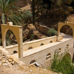
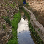
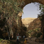
Aqueduct crossing Wadi Qelt (© vizAviz)

The view from the balcony of the inner court includes Roman aqueducts supported by massive walls on the other side of the wadi.


Administered by: Greek Orthodox Patriarchate of Jerusalem

Tel.: 054 7306557

Open: 9am-1pm; Sunday closed.


References

Bourbon, Fabio, and Lavagno, Enrico: The Holy Land Archaeological Guide to Israel, Sinai and Jordan (White Star, 2009)
Cohen, Daniel: The Holy Land of Jesus (Doko Media, 2008)
Freeman-Grenville, G. S. P.: The Holy Land: A Pilgrim’s Guide to Israel, Jordan and the Sinai (Continuum Publishing, 1996)
Giroud, Sabri, and others, trans. by Carol Scheller-Doyle and Walid Shomali: Palestine and Palestinians (Alternative Tourism Group, 2008)
Murphy-O’Connor, Jerome: The Holy Land: An Oxford Archaeological Guide from Earliest Times to 1700 (Oxford University Press, 2005)
Rossing, Daniel: Between Heaven and Earth: Churches and Monasteries of the Holy Land (Penn Publishing, 2012)

 

External links

St. George’s Monastery, Wadi Kelt (360cities)
Tomb of King David

Jerusalem


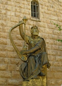
One of the holiest sites for Jews is the building on Mount Zion known as the Tomb of King David — the celebrated Old Testament warrior king of Israel who is traditionally credited with composing many of the Psalms.

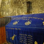
King David's Tomb after extensive renovations were completed in 2014 (Seetheholyland.net)

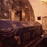
King David’s Tomb after extensive renovations were completed in 2013 (Seetheholyland.net)

The Old Testament clearly indicates that David was buried somewhere else. However, the site — directly underneath the Cenacle, where Christians commemorate the Last Supper — remains a place of pilgrimage for Jews, Muslims and Christians.

David’s death at the end of his 40-year reign is recorded in 1 Kings 2:10: “Then David slept with his ancestors and was buried in the city of David.”

Archaeologists have shown that the City of David, also called Zion (or Sion), was the low spur south of the Temple Mount and east of the present Mount Zion.

This area, also known as Ophel, is now known to have been the original Jerusalem — making it much older than what is now called the Old City.

But excavations here since the 1800s have failed to identify the royal tomb. (Another tradition places the burial of David in Bethlehem, but excavations have not revealed the tomb there either.)


Temple Mount moved across the valley

Tomb of King David

Statue of King David outside the Tomb of King David (Seetheholyland.net)

How did the confusion over David’s burial place arise? There are two likely reasons.

• First, perhaps at the time Solomon built his Temple, the Temple Mount came to be called Mount Zion. In the first century AD, following the Roman destruction of Jerusalem, the name was transferred to its present location across the Tyropoeon Valley.

Until excavations in the 19th century, archaeologists believed that the city of David was on this hill too.

• In the 10th century a belief that David’s tomb was on the present Mount Zion began to develop among Christian pilgrims, who celebrated David’s memory along with that of St James, the first bishop of Jerusalem.

It was actually the Christian Crusaders who built the present Tomb of David with its large stone cenotaph. However, three of the walls of the room where the cenotaph stands are much older — apparently from a synagogue-church used by first-century Judaeo-Christians, which became known as the Church of the Apostles.

Gradually this memorial came to be accepted as David’s tomb, first by the Jews and later also by Muslims.


Sarcophagus is empty

Tomb of King David

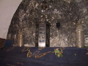
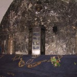
Torah case in niche over Tomb of King David (Picturesfree.org)

Entry to the Tomb of David is through a courtyard which is part of a former Franciscan monastery that was closed in 1551.

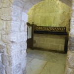
The complex has three simple rooms, all without furniture except for wooden benches.

The entrance hall is used as a synagogue. There is a Christian tradition that this is where Christ washed his disciples’ feet during the Last Supper.

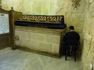
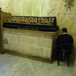
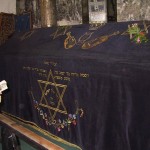
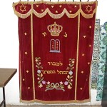
The massive cenotaph stands in front of a niche blackened by pilgrims’ candles. Over it is draped a velvet cloth with embroidered stars of David and inscriptions from the Jewish Scriptures. On it are scrolls of the Torah (the first five books of the Hebrew Bible) in ornate cases.

The cenotaph is an empty sarcophagus. In 1859 an Italian engineer, Ermete Pierotti, investigated the tomb and reported that underneath was a small, shallow and empty cave.


Special significance until 1967

The Tomb of David was of special significance to Jews between 1948, when the state of Israel was founded, and 1967.

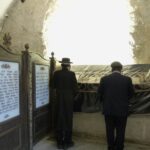
During this period the Old City was under Jordanian control and there was no access to the Western Wall of the Temple Mount. Since Mount Zion was in Israeli control, Jews would come to the Tomb of David to pray.


In Scripture:

King David’s last words: 2 Samuel 23:1-7

King David’s death: 1 Kings 2:10

King David’s reign: 1 Chronicles 29:26-30


Administered by: Israel Ministry of Religious Services

Tel.: 972-2-5388605

Open: 8am-sunset (closes on Fridays at 2pm Apr-Sep and 1pm Oct-Mar). Men and women are separated. Men should cover their heads (kippahs are provided).


References

Gonen, Rivka: Biblical Holy Places: An illustrated guide (Collier Macmillan, 1987)
Inman, Nick, and McDonald, Ferdie (eds): Jerusalem & the Holy Land (Eyewitness Travel Guide, Dorling Kindersley, 2007)
Mackowski, Richard M.: Jerusalem: City of Jesus (William B. Eerdmans, 1980)
Poni, Shachar: “Renovating Royal Tomb” (The Jewish Voice, February 5, 2010)
Wareham, Norman, and Gill, Jill: Every Pilgrim’s Guide to the Holy Land (Canterbury Press, 1996)


External links

King David’s Traditional Tomb (CenturyOne Foundation)
Church of the Apostles found on Mt Zion (Century One Foundation)

Dome of the Ascension

Jerusalem

Dome of the Ascension

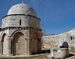
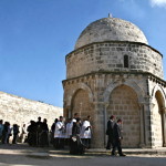
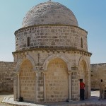
Dome of the Ascension (© Israel Ministry of Tourism)

The shrine marking the place where Jesus is believed to have ascended to heaven offers Christians a disappointing experience.

All that remains of the several churches built to celebrate the Ascension is a small octagonal structure on a property that is now part of a mosque.

Plain and unadorned, the Dome of the Ascension stands in a walled compound east of the main road that runs on the top of the Mount of Olives in Jerusalem. The location is just north of the Church of Pater Noster — which is built over a cave that the first Christians used as a more secluded place to commemorate the Ascension.

The last church on the site was captured by the Muslim sultan Saladin when he defeated the Crusaders in 1187. Since Muslims also believe in the Ascension of Jesus, it was converted into a mosque.

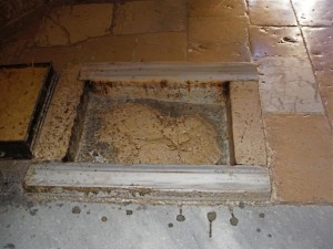
An unusual feature of the tiny building is that it contains what has been traditionally regarded as the last impression of Jesus’ right foot on earth before he ascended into heaven.


First church was open to the sky

Dome of the Ascension

Footprint stone in Dome of Ascension (Seetheholyland.net)

The first church on the hill was funded by Poemenia, a wealthy Roman woman who was a member of the imperial family, around AD 380.

Known as the Imbomon (Greek for “on the hill”), it was a rotunda, open to the sky, surrounded by circular porticos and arches. In the centre of the stone floor was a rock on which it was believed Jesus’ final footprints could be seen in the dust.

By 670 the original structure had been destroyed and rebuilt but the English pilgrim Arculf reported to his countrymen that the footprints were still to be seen in the dust of its floor.

In the 12th century the Crusaders rebuilt an octagonal chapel, set within a fortified monastery. From this strategic position on the crest of the Mount of Olives, the Crusaders controlled the road between Jericho and Jerusalem.

The footprints were still venerated, but now they were reported to be carved into the face of the rock.

Part of this rock remains today in the Dome of the Ascension, although the Muslims have moved it adjacent to a mihrab they inserted to indicate the direction of Mecca. They took the section bearing the left footprint to the Al-Aqsa Mosque on the Temple Mount, where it was placed behind the pulpit there.


Christian celebrations are allowed

Dome of the Ascension

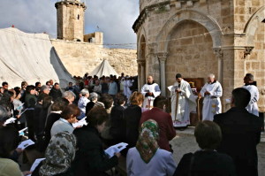
Celebrating the Ascension at the Dome of the Ascension (© Custodia Terrae Sanctae)

The Muslims also walled in the open spaces between the columns and put a dome over the opening in the roof.

The ornately carved capitals on top of the columns are well preserved. The designs depict foliage and fabulous animals.

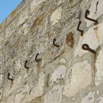
The various Christian communities are permitted to hold celebrations here on their Ascension feast days. Hooks in the courtyard wall are used to erect their awnings, ribbons and flags on these occasions.

To the right of the entrance to the Dome of the Ascension is a small mosque built in 1620.

An underground tomb near the entrance is revered by all three monotheistic religions, although they differ about its occupant. Jews believe it contains the Old Testament prophetess Huldah; Christians regard it as the grave of the 5th-century St Pelagia; Muslims maintain it is the tomb of the Sufi holy woman Rabi’a al-’Adawiyya (for whom the mosque is named).


Three more recent Ascension churches

Three more recent churches on the Mount of Olives commemorate the Ascension.

At the summit is the Russian Orthodox Church of the Ascension, dating from the late 19th century. Its tall tower, one of Jerusalem’s most prominent landmarks, was built to enable pilgrims to see the Jordan River.

On the north side is the German Lutheran Church of the Ascension (also known as Augusta Victoria, after the wife of the Emperor Wilhelm II of Germany who initiated plans for the church in 1898), dating from the early 20th century. Its fortress-like compound with a tall bell tower now hosts a hospital for the Palestinian population of Jerusalem.

Between the Russian and Lutheran churches is the Greek Orthodox Viri Galilaei Church. Its name means “men of Galilee”, a reference to the question posed to the apostles by two men in white after the Ascension: “Men of Galilee, why do you stand looking up to heaven…?”

Related site: Church of the Ascension


In Scripture:

The Ascension of Jesus: Luke 24:50-51; Acts 1:4-11

Administered by: Islamic Waqf Foundation

Open: Daily (if door is not open, ring the bell)


References

Bagatti, Bellarmino: “ ‘Footprints’ of the Saviour on the Mount of Olives”, Holy Land, winter 2005.
Bar-Am, Aviva: Beyond the Walls: Churches of Jerusalem (Ahva Press, 1998)
Inman, Nick, and McDonald, Ferdie (eds): Jerusalem & the Holy Land (Eyewitness Travel Guide, Dorling Kindersley, 2007)
Gonen, Rivka: Biblical Holy Places: An illustrated guide (Collier Macmillan, 1987)
Murphy-O’Connor, Jerome: The Holy Land: An Oxford Archaeological Guide from Earliest Times to 1700 (Oxford University Press, 2005)
Walker, Peter: In the Steps of Jesus (Zondervan, 2006)
Wareham, Norman, and Gill, Jill: Every Pilgrim’s Guide to the Holy Land (Canterbury Press, 1996)


External links

Chapel of the Ascension, Jerusalem (Sacred Destinations)
Chapel of Ascension (BibleWalks)
Chapel of the Ascension panorama (Jesus in Jerusalem)

Bethphage

Jerusalem

The village of Bethphage is remembered as the starting point of Jesus’ triumphal entry into Jerusalem on the day that is commemorated as Palm Sunday.

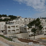
Bethphage

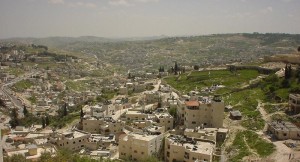
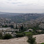
Panorama of modern Bethphage (© Custodia Terrae Sanctae)

The exact location of the village, on the eastern slope of the Mount of Olives and close to Bethany, is uncertain.

Bethphage was considered the outermost reach of the city of Jerusalem, the limit of a Sabbath-day’s journey (900 metres) from the city, and the furthest point at which bread could be baked for use in the Temple.

The name in Hebrew means “House of unripe figs” — recalling that in this area Jesus caused a fig tree with no fruit to wither (Matthew 21:18-22).

The memory of Jesus’ triumphal entry into Jerusalem is kept in a Franciscan church built beside the steep road that descends from the Mount of Olives eastwards towards the village of El-Azariyeh (ancient Bethany) and the Jerusalem-Jericho highway.

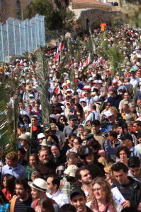
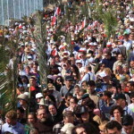
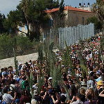
This is where the annual Palm Sunday walk into Jerusalem begins — a tradition begun during Crusader times.


Disciples saw a prophecy fulfilled

Bethphage

Palm Sunday procession from Bethphage on the Mount of Olives (© Custodia Terrae Sanctae)

As the Gospels record, Jesus sent two of his disciples to find a donkey and her colt, and he rode into Jerusalem while crowds spread their cloaks and branches on the road, shouting “Hosanna to the Son of David! Blessed is the one who comes in the name of the Lord!”

Recalling the sight of their master riding a beast of burden, the disciples saw the fulfilment of a prophecy by Zechariah more than 500 years before: “Shout aloud, O daughter Jerusalem! Lo, your king comes to you; triumphant and victorious is he, humble and riding on a donkey, on a colt, the foal of a donkey.” (Zechariah 9:9)

It was on his way to Jerusalem that Jesus stopped on the summit of the Mount of Olives, overlooking the panorama of the Temple, towers and palaces, and wept over the city as he predicted its impending destruction only 40 years in the future.


‘Mounting-block’ is queried

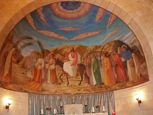
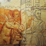
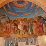
Above the altar in the church is a mural of Jesus riding the donkey and receiving the acclaim of crowds.

Bethphage

Jesus on the donkey, a mural in the Franciscan church (Seetheholyland.net)

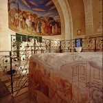
On display in the church, protected by a wrought iron grille, is a large square rock that the Crusaders regarded as the mounting-block Jesus used to mount the donkey.

Biblical scholar Jerome Murphy-O’Connor is sceptical, suggesting the Crusaders forgot that “a Palestinian donkey was in no way comparable to their huge battle-chargers”.

On the sides of the rock are medieval paintings, restored in 1950. These depict the disciples collecting the donkey and colt; people holding palm branches; the resurrection of Lazarus at nearby Bethany; and the inscription “Bethphage”.

Just up the hill is a Greek Orthodox church whose courtyard offers a view and a place for reflection.


In Scripture

Jesus’ entry into Jerusalem: Matthew 21:1-11

Administered by:

Franciscan Custody of the Holy Land

Tel.: 972-2-6284352

Open: Apr-Sep 8am-noon, 2-5pm, Oct-Mar 8am-noon, 2-4.30pm


References

Freeman-Grenville, G. S. P.: The Holy Land: A Pilgrim’s Guide to Israel, Jordan and the Sinai (Continuum Publishing, 1996)
Gonen, Rivka: Biblical Holy Places: An illustrated guide (Collier Macmillan, 1987)
Mackowski, Richard M.: Jerusalem: City of Jesus (William B. Eerdmans, 1980)
Murphy-O’Connor, Jerome: The Holy Land: An Oxford Archaeological Guide from Earliest Times to 1700 (Oxford University Press, 2005)
Wareham, Norman, and Gill, Jill: Every Pilgrim’s Guide to the Holy Land (Canterbury Press, 1996)

External link

Bethphage (Custodia Terrae Sanctae)

Acre

Israel

Acre

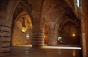
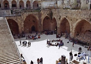
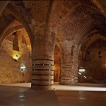
St John’s Crypt in the Crusaders’ Hospitaller Quarter at Acre (© Israel Ministry of Tourism)

Because Acre, 22 kilometres north of Haifa, had the best natural harbour on the coast of the Holy Land, it achieved importance from early times.

But its role as the main stronghold of the Crusaders made the most lasting impression on its long and chequered history.

Before the Crusaders took Acre in 1104, the city had been captured by Egyptians, Phoenicians, Persians, Greeks and Muslims. Its name had been expressed as Acre, Akko, Acco or Accho.

It was King Ptolemy of Egypt who called it Ptolemais, the name mentioned by St Luke (Acts 21:7) when he and St Paul visited it at the end of Paul’s third missionary journey around AD 58.

By then a Christian community was already established. Christianity spread rapidly in the city and by AD 190 it had a bishop.


Crusaders made Acre their capital

By the 11th century, Muslim forces were oppressing Palestine’s Christians and harassing pilgrims, so the Emperor of Constantinople appealed to Pope Urban II for armies to aid the Christians.

Acre

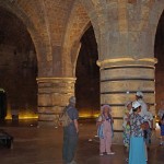
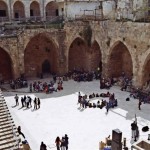
Courtyard of the Hospitaller Quarter in Acre (© Israel Ministry of Tourism)

The Pope called for a Crusade from Europe to wrest the Holy Land, in particular the Holy Sepulchre in Jerusalem, from Muslim control.

The Crusaders captured Acre in 1104. They made it their capital and the main link between their Latin kingdom and Europe. They also gave it another name, St Jean d’Acre, in honour of the Knights Hospitallers of St John of Jerusalem.

In 1187 Acre fell again to Muslims after the Kurdish general Saladin finally ended the Crusader kingdom at the battle of the Horns of Hattin, overlooking the Sea of Galilee.

In 1191 Richard the Lionheart of England and Philip Augustus of France took Acre back. The Crusaders held the city until 1291, when Mamluk forces penetrated its massive fortifications.

Acre was almost totally destroyed and lay in ruins for 450 years.

Remains of Crusader city can be seen

Acre

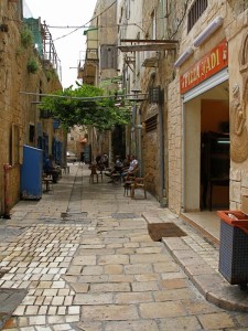
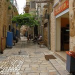
Street scene in old Acre (Seetheholyland.net)

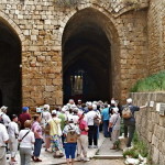
Among Acre’s bewildering network of narrow streets, today’s visitors can see much of the old Crusader city. The extensive remains are sometimes referred to as the “Underground City” because they lie well below street level.

The most important edifice is the great refectory hall of the Knights Hospitallers of St John, a chivalrous order concerned with the health and spiritual welfare of pilgrims. It is a fine example of Crusader architecture.

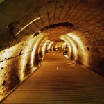
A pit in the hall gives access to an underground passage (perhaps originally a sewer from well before the time of Christ) which the Crusaders discovered and maintained.

There are also Gothic knights’ halls (not all open to the public), each belonging to one of the nations represented in the crusading Order of the Knights Hospitallers: Auvergne, England, France, Germany, Provence and Spain.


St Francis and Marco Polo visited

After the Crusader kingdom collapsed, St Francis of Assisi arrived at Acre in 1219. He had gone to Egypt with the Fifth Crusade and walked into a Muslim camp. His peace-loving nature impressed the sultan, Melek-el-Kamel, who allowed him to visit the holy places, then off limits to Christians. Today many of these sites are maintained by the Franciscan Custody of the Holy Land.

Acre

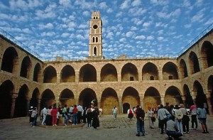
Khan al-Umdan (Inn of the Pillars) at Acre (© Israel Ministry of Tourism)

The Venetian traveller Marco Polo was a later visitor. He made Acre the staging point for his great journey to the Orient.

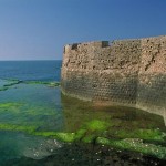
In the second half of the 18th century, Acre became ruled by a local Arab sheik and then by a harsh Albanian soldier of fortune, Ahmed Pasha, who became known as “al-Jazzar” (the Butcher). The walls were built at this time and they resisted a 60-day siege by Napoleon in 1799.

The present Acre is largely an 18th-century Turkish town built on the ruins of the old city, and almost surrounded by Jewish suburbs.

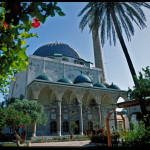
Above the Crusader town stands the dominant landmark of Ahmed Pasha’s domed mosque, known especially for its beautiful courtyard.

Acre’s old city has been designated a UNESCO World Heritage Site and many archaeological digs have taken place there. Large-scale renovations and rebuilding have taken place, and slick audio-visuals introduced to present the history of the impressive remains to tourists.

In Scripture:

Paul arrives at Ptolemais: Acts 21:7


References

Brownrigg, Ronald: Come, See the Place: A Pilgrim Guide to the Holy Land (Hodder and Stoughton, 1985)
Freeman-Grenville, G. S. P.: The Holy Land: A Pilgrim’s Guide to Israel, Jordan and the Sinai (Continuum Publishing, 1996)
Gonen, Rivka: Biblical Holy Places: An illustrated guide (Collier Macmillan, 1987)
Inman, Nick, and McDonald, Ferdie (eds): Jerusalem & the Holy Land (Eyewitness Travel Guide, Dorling Kindersley, 2007).
Murphy-O’Connor, Jerome: The Holy Land: An Oxford Archaeological Guide from Earliest Times to 1700 (Oxford University Press, 2005)
Wareham, Norman, and Gill, Jill: Every Pilgrim’s Guide to the Holy Land (Canterbury Press, 1996)

External links:

Acre (Custodia Terrae Sanctae)
Acre (Akko) (BibleWalks)
Acco, Ptolemais, Acre (BiblePlaces)
Akko (Israel Ministry of Foreign Affairs)
All content © 2022, See the Holy Land | Site by Ravlich Consulting & Mustard Seed
You are welcome to promote site content and images through your own
website or blog, but please refer to our Terms of Service | Login