Jerusalem
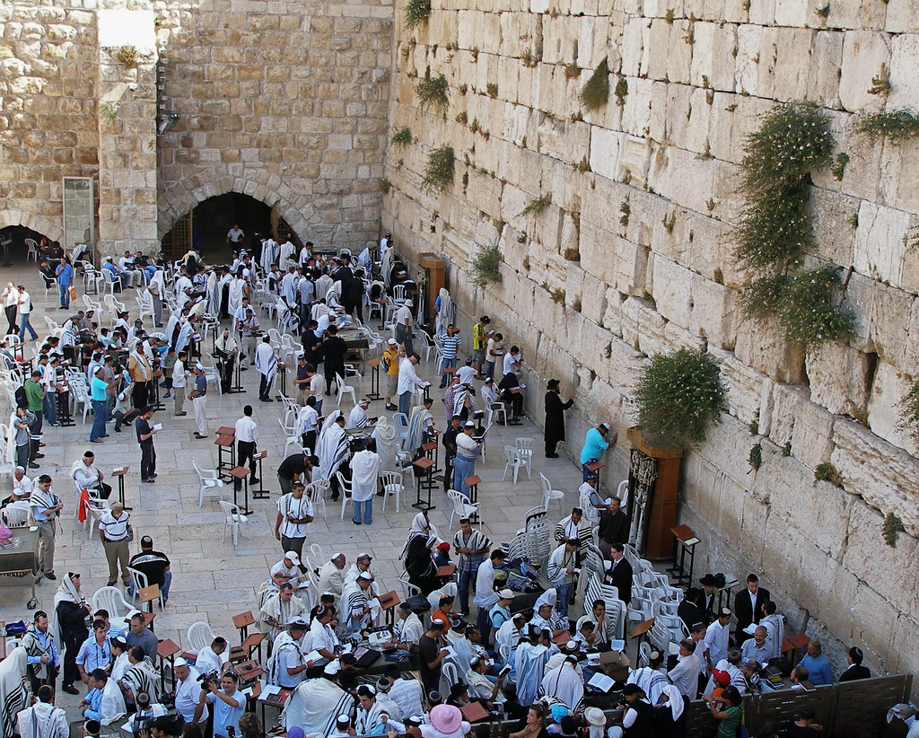
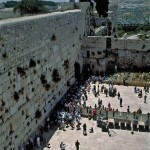
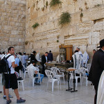
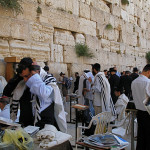
Jews and visitors at the Western Wall in Jerusalem (Seetheholyland.net)
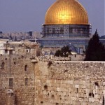
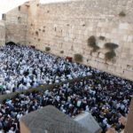
Judaism’s holiest place is the Western Wall in the Old City of Jerusalem. Part of the retaining wall erected by Herod the Great in 20 BC to support the vast plaza on which he rebuilt the Temple, it is venerated as the sole remnant of the Temple.
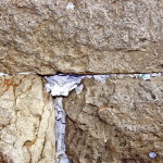
The wall and the plaza in front of it form a permanent place of worship, a site of pilgrimage for Jews and a focus of prayer — often petitions written down and placed between the huge stones. The Jewish name for the wall is the Kotel.
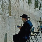
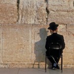
Orthodox Jewish men, fully bearded and garbed in black, bowing their heads as they read and pray from the Torah, are a common sight.
It is also the place where Jews down the ages have expressed their grief over the destruction of the Temple, their anguish giving the wall another name — the Wailing Wall.
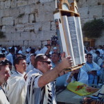
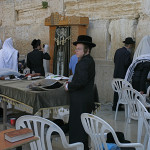
But the wall is also a place for celebrations, especially of Bar and Bat Mitzvahs (coming-of-age ceremonies for Jewish sons and daughters).
Stones weigh up to eight tons
In the exposed part of the Western Wall today, the seven lowest layers of stones are from Herod’s construction. Most of these stones weigh between two and eight tons.
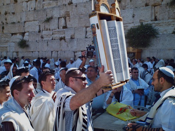
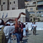
Celebrating bar mitzvah at the Western Wall (Margaret O’Sullivan / Seetheholyland.net)
Above these are stones placed in later centuries, replacing those forced out when the Romans put down a Jewish revolt by sacking Jerusalem and destroying the Temple in AD 70.
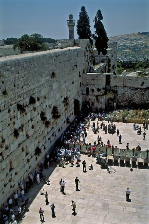
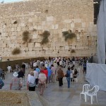
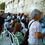
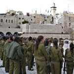
The prayer area in front of the wall is divided into separate sections for men and women.
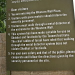
Men and married women who approach the wall are expected to have their heads covered. A kippah (skullcap) is provided free of charge. Cameras and electronic devices are forbidden on Saturdays.
To the right of the plaza, near the southern end of the Temple Mount, large stones jutting out of the wall are the remains of what is called Robinson’s Arch. This arch once supported a grand staircase to the Temple.
Valley was filled in
Divided prayer areas at the Western Wall (© Israel Ministry of Tourism)
In the time of Christ a deep valley, spanned by bridges, ran beside the Western Wall and eight more levels of stones were visible. Through the centuries this valley, the Tyropoeon, has been progressively filled in with masonry and rubble.
Mark 13:1 recounts that one of Jesus’ disciples exclaimed to him as they left the Temple: “Look, Teacher, what large stones and what large buildings!” Jesus replied: “Not one stone will be left here upon another; all will be thrown down.”
The Western Wall was captured by Jordan during the 1948 Arab-Israeli War and recaptured by Israel during the 1967 Six-Day War.
Arab housing and mosques near the wall were immediately razed. In their place, today’s plaza was created, stretching from the wall to the Jewish Quarter.
At the left end of the Western Wall is the entrance to a tunnel which allows visitors to walk along 500 metres of the extended wall, under buildings of the Old City. Sights include the biggest stone in the wall, estimated to weigh 570 tons.
In Scripture:
Solomon builds the Temple: 1 Kings 5-6
Jesus foretells the destruction of the Temple: Mark 13:1-8
Administered by: Western Wall Heritage Foundation
Tel.: 972-2-6271333
Open: All day, every day
-
- Jews and visitors at the Western Wall in Jerusalem (Seetheholyland.net)
-
- Divided prayer areas at the Western Wall (© Israel Ministry of Tourism)
-
- Celebrating bar mitzvah at the Western Wall (Margaret O’Sullivan / Seetheholyland.net)
-
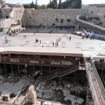
- Excavations beneath Western Wall plaza (Seetheholyland.net)
-
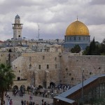
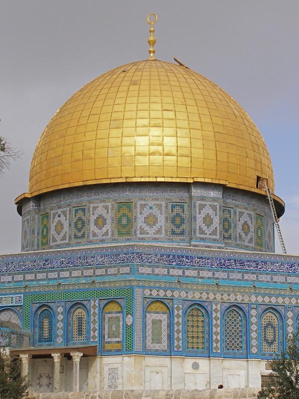
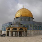
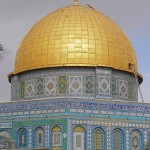
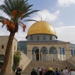
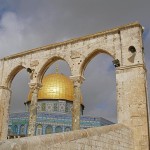
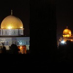
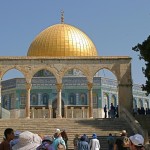
- Al-Aqsa Mosque and Dome of the Rock tower over the Western Wall (Seetheholyland.net)
-
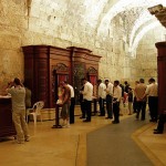
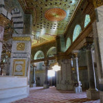
- Inside men’s prayer hall (Seetheholyland.net)
-
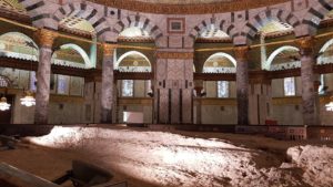
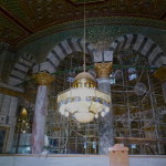
- Men’s prayer hall under Wilson’s Arch (Seetheholyland.net)
-
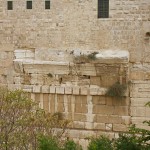
- Remains of Robinson’s Arch, which supported a stairway to the Temple (Seetheholyland.net)
-
- Women’s section of Western Wall (Seetheholyland.net)
-
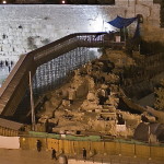
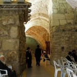
- Excavations near the Western Wall (J. M. Rosenfeld)
-
- A ram’s horn (shofar) sounds at the Western Wall (Margaret O’Sullivan / Seetheholyland.net)
-
- Praying at the Western Wall (© Israel Ministry of Tourism)
-
- Women at the Western Wall (Margaret O’Sullivan / Seetheholyland.net)
-
- Jewish men at the Western Wall (Tom Callinan / Seetheholyland.net)
-
- Jews and visitors at the Western Wall (Seetheholyland.net)
-
- Hassidic Jew praying at the Western Wall (© Israel Ministry of Tourism)
-
- Celebrating bar mitzvah at the Western Wall (Margaret O’Sullivan / Seetheholyland.net)
-
- Praying at the Western Wall (Seetheholyland.net)
-
- Army graduates at the Western Wall (© Chris Yunker)
-
- Prayer notes in the Western Wall (© Israel Ministry of Tourism)
-
- Rules for visitors to the Western Wall (James Emery)
-
- Entrance to the Western Wall plaza (Seetheholyland.net)
-
- Crowds at Western Wall during Sukkot, the Feast of Tabernacles (Seetheholyland.net)
References
Charlesworth, James H.: The Millennium Guide for Pilgrims to the Holy Land (BIBAL Press, 2000)
Inman, Nick, and McDonald, Ferdie (eds): Jerusalem & the Holy Land (Eyewitness Travel Guide, Dorling Kindersley, 2007).
Gonen, Rivka: Biblical Holy Places: An illustrated guide (Collier Macmillan, 1987)
Maier, Paul L. (trans.): Josephus: The Essential Writings (Kregel Publications, 1988)
McCormick, James R.: Jerusalem and the Holy Land (Rhodes & Eaton, 1997)
Murphy-O’Connor, Jerome: The Holy Land: An Oxford Archaeological Guide from Earliest Times to 1700 (Oxford University Press, 2005)
Wareham, Norman, and Gill, Jill: Every Pilgrim’s Guide to the Holy Land (Canterbury Press, 1996)
External links