
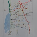
Click here to load a full-resolution version of the map as a PDF, ready for A4 printing (1.2MB).

Click here to load a full-resolution version of the map as a PDF, ready for A4 printing (1.2MB).
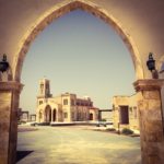
Jordan
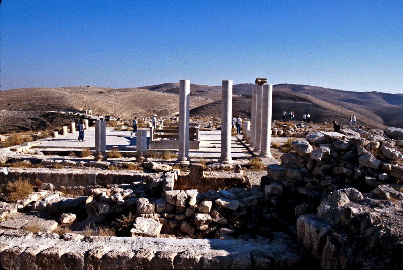
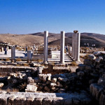
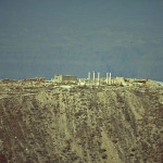
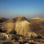
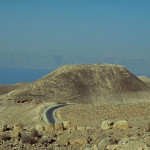
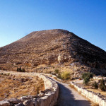
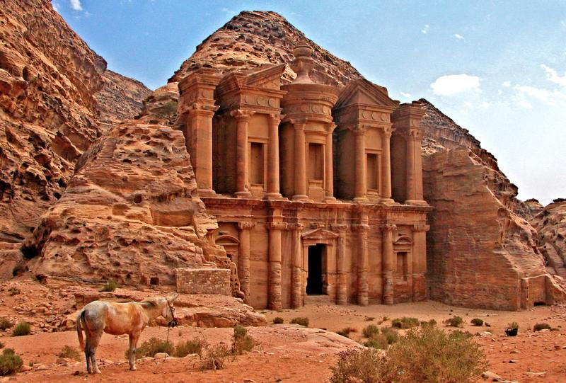
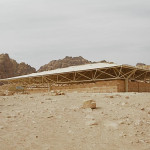
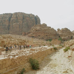
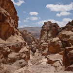
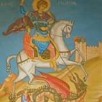
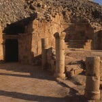
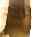
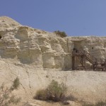
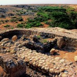
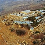
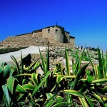
The hilltop fortress of Machaerus, on the eastern side of the Dead Sea and 53 kilometres southwest of Amman, is recorded as the place where John the Baptist was imprisoned and beheaded.
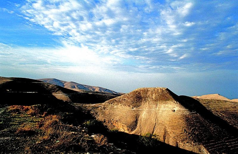
Herod’s stronghold of Machaerus (© Visitjordan)
John preached a baptism of repentance at the Jordan River and foretold the coming of Jesus the Messiah, who was his cousin.
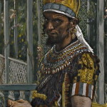
He also criticised Herod Antipas, the governor of Galilee and Perea, for unlawfully marrying his half-brother’s wife, Herodias — thereby earning her enmity.
Herod Antipas imprisoned John, but Mark’s Gospel says he protected him, “knowing that he was a righteous and holy man”, and “liked to listen to him” (6:20).
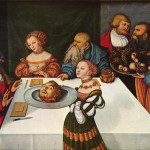
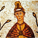
The governor’s birthday banquet for the leaders of Galilee gave Herodias her opportunity to get rid of John. Her daughter, Salome, danced for the gathering and so enthralled Herod that he offered her whatever she wanted — “even half of my kingdom” (6:23).
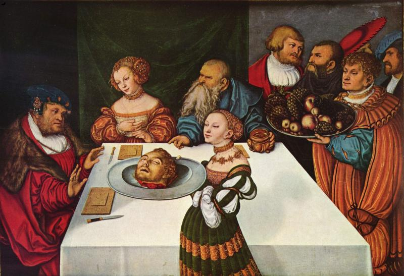
Salome with the Head of John the Baptist, by Lucas Cranach the Elder, 1531 (The Yorke Project)
Salome, who was probably no older than 14 (so her dance might not have been the erotic performance usually imagined), sought her mother’s advice and then asked for John the Baptist’s head.
Herod, “deeply grieved”, gave the order. John was executed and his head brought in “on a platter”. John’s disciples took away his body for burial. (6:26-29)
According to the historian Josephus, John’s execution took place at Machaerus. An early Christian tradition says his body was buried at Sebastiya in Samaria, which Orthodox Christians believe was also the venue for the banquet.
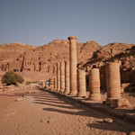
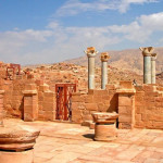
Machaerus (the name means “black fortress”) was one of a series of hilltop strongholds established by Herod the Great — the father of Antipas — along the edge of the Jordan Valley and Dead Sea.
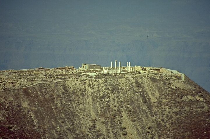
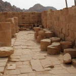
Ruins of Herod’s palace on Machaerus (© Dan Gibson)
Protected on three sides by deep ravines, it afforded seclusion and safety in times of political unrest. Fire signals linked Machaerus to Herod’s other fortresses and to Jerusalem.
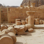
On top of the mountain, more than 1100 metres above the Dead Sea, Herod erected a fortress wall with high corner towers. In the centre he built a palace that was “breathtaking in size and beauty”, according to Josephus. Numerous cisterns were dug to collect rainwater.
When Herod the Great died in 4 BC, Machaerus passed to his son Herod Antipas, who ruled Galilee and Perea (an area on the eastern side of the Jordan River) until AD 39.
Herod Antipas had married Phasaelis, daughter of King Aretas of Nabatea, the kingdom whose capital was Petra. But while visiting Rome in AD 26 he stayed with his half-brother Herod Philip I and fell in love with Philip’s wife Herodias.
When Phasaelis learnt that Antipas intended to divorce her and marry Herodias, she obtained permission to visit Machaerus and from there fled to her father in Nabatea.
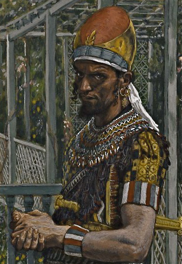
Herod Antipas, by James Tissot (Brooklyn Museum)
Antipas’s rejection of Phasaelis added a personal note to existing disputes with King Aretas over the boundary of Perea and Nabatea. In AD 36 Aretas attacked Antipas and completely destroyed his army.
According to Josephus, some of the Jews saw this devastating defeat as divine retribution for killing John the Baptist.
Some time before the war with Aretas, Jesus was arrested in Jerusalem and brought before Pontius Pilate. When Pilate learnt that Jesus came from Galilee, he sent him to Herod Antipas, who was also in Jerusalem at the time.
Luke’s Gospel says Antipas “had been wanting to see him for a long time” and “was hoping to see him perform some sign”. He questioned Jesus at length, but Jesus gave no answer. Antipas then mocked Jesus and sent him back to Pilate in an elegant robe. (23:8-11)
In AD 39 Herod Antipas was accused of conspiring against the Roman emperor Caligula, who exiled him to Gaul.
At the time of the First Jewish Revolt (AD 66-73), Machaerus was in the hands of Jewish rebels. Roman forces took the fortress only by deception — they captured a young Jewish defender and threatened to crucify him if the rebels did not surrender.
Columns from Herod’s palace on Machaerus (© Dan Gibson)
When the rebels agreed to abandon Machaerus, the Romans systematically dismantled the Herodian fortifications.
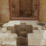
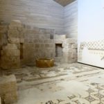
Excavations at the site have uncovered remains of Herod’s palace, including rooms designed around a central courtyard, an elaborate bath and floor mosaics.
Work on partially reconstructing the throne room where Salome is said to have danced was begun by archaeologists in 2020.
Below the hilltop ruins on the eastern side is the village of Mukawir, where excavations have found evidence of three Byzantine churches built in the 6th century.
In Scripture
Herod Antipas executes John the Baptist: Mark 6:14-29; Matthew 14:1-12; Luke 3:18-20
Jesus appears before Herod Antipas: Luke 23:8-11
Jordan
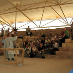
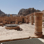
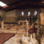
Pilgrims holding a service in Petra Church (Seetheholyland.net)
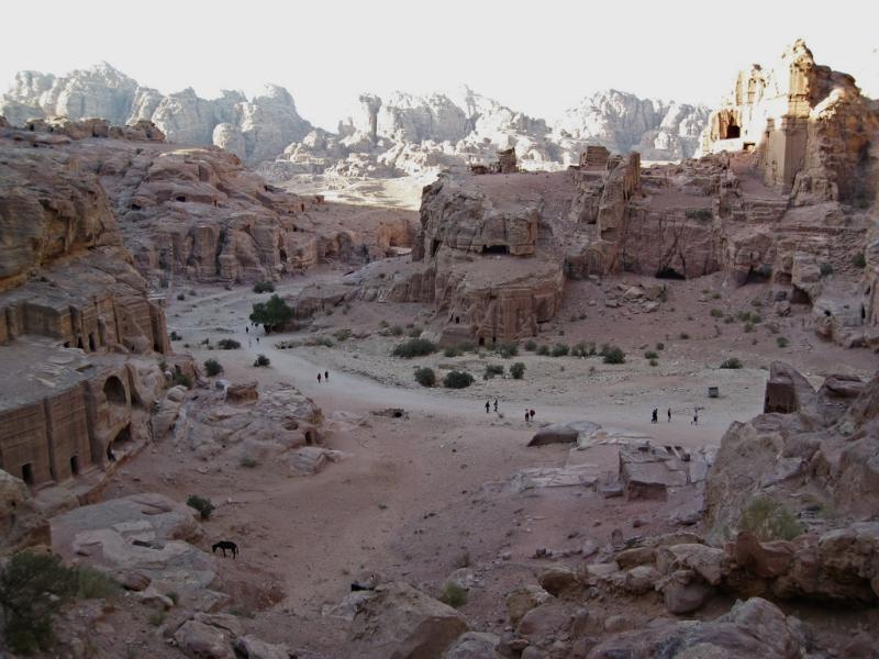
The “rose-red city” of Petra in southern Jordan, famous for its rock-cut monumental buildings, was once the setting for a thriving Christian community with several significant churches.
An early account tells of Christians in Petra being martyred during the persecution of emperor Diocletian at the beginning of the 4th century, for refusing to offer sacrifice to Roman gods.
Nevertheless, a Christian presence persisted. Bishops from Petra attended Church synods and councils from AD 343, indicating that the city had become a significant Christian centre.
Crosses chiselled into sandstone walls show which large tombs were converted into churches. Then a succession of new churches was built.
Multicoloured sandstone at Petra (Seetheholyland.net)
The Roman historian Epiphanius mentions that the conversion of Petra’s residents was a slow process throughout the late 4th and 5th centuries.
Then a monk called Mar Sauma arrived with 40 brother monks in AD 423. They found the gates locked against them, but a rainstorm struck with such intensity that part of the city wall was broken, allowing them in. Since the storm had broken a four-year drought, the water-dependent Nabateans saw the event as miraculous and even pagan priests converted to Christianity.
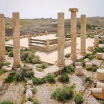
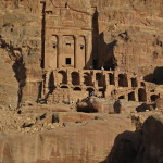
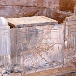
Three churches from the Byzantine era — called the Petra Church, the Blue Chapel and the Ridge Church — have been discovered. They are clustered on the ridge to the north-east of the Colonnaded Street that runs through Petra’s main city area, past the Temple of the Winged Lions.
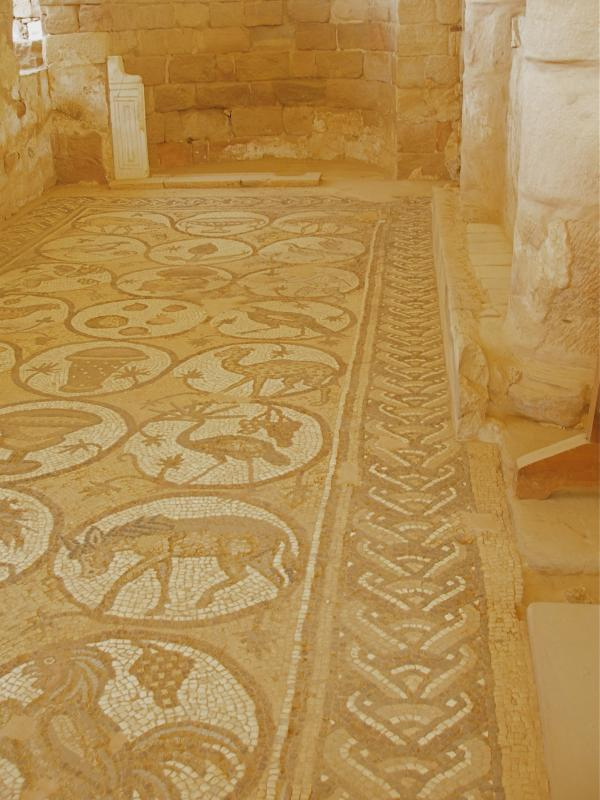
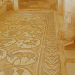
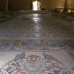
Aisle of mosaics in Petra Church (Seetheholyland.net)
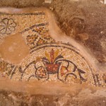
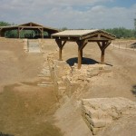
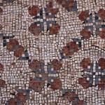
The large triple-aisled Petra Church, a basilica dedicated to St Mary, was probably the ancient city’s cathedral.
Little of the interior remains except for well-preserved mosaics carpeting the 70-square-metre floors of each of the side aisles. These depict local, exotic and mythological animals, as well as personifications of the Seasons, Ocean, Earth and Wisdom.
The secular nature of these mosaics is probably explained by a reluctance to tread on sacred images.
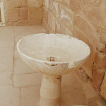
Just west of the church proper is a stone-paved atrium, with a cistern sunk into the centre to catch water. Further west is a baptistery, with a cross-shaped baptismal font.
The basilica was destroyed by a fire, probably in the early 7th century.
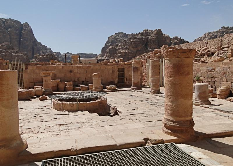
Petra Church atrium and water cistern (Bernard Gagnon)
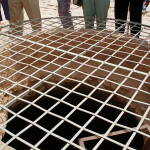
The fire that destroyed the Petra Church also carbonised an invaluable hoard of papyrus scrolls cached in a church storeroom. The 152 scrolls — the largest collection of written material from antiquity found in Jordan — lay undiscovered until 1993.
Written mainly in cursive Greek, they have been painstakingly deciphered to reveal details of births, prenuptial arrangements, marriages, business deals, wills, properties disputes and tax responsibilities of about 350 members of the community.
One of the main figures identified in the scrolls is Theodorus, who married his cousin Stephanous in 537, when he was aged about 24. Later ordained a deacon in the Petra diocese, Theodorus was also a successful landowner with extensive business interests.

Baptistery of Petra Church (Seetheholyland.net)
A son of Theodorus is recorded as being responsible for paying local taxes on a vineyard — at the rate of 47.5 per cent! This affluent family apparently owned much property in the Petra region.
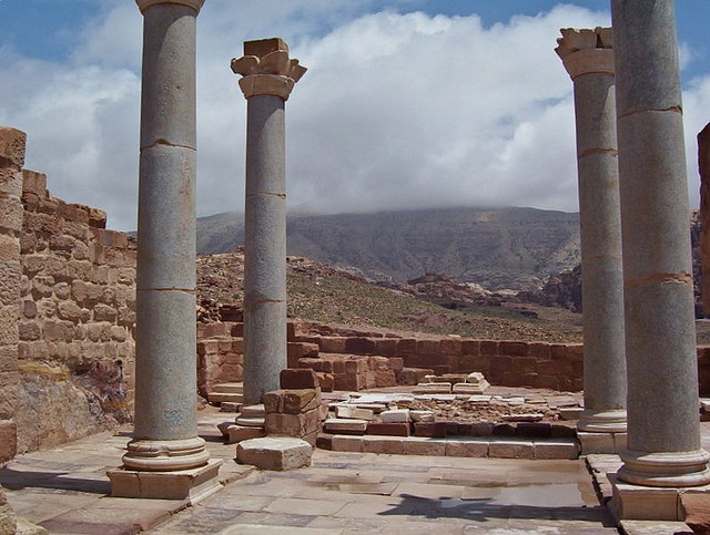
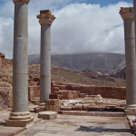
The Ridge Church had a commanding position, with a 360-degree view of the central city, atop the northern slope of the valley in which Petra sits.
The oldest church in the city, dating from the 4th century, it had two side aisles separated from the nave by five columns on each side.
Behind it, city walls across the valley would have protected Petra against invasion from the north.
Granite columns at Blue Church (David Loong)
Between the Petra Church and the Ridge Church is the Blue Chapel, so named after its four blue Egyptian granite columns, topped with Nabataean horned capitals, that collapsed in an 8th-century earthquake but have been re-erected.
The chapel also had blue sandstone flooring and blue marble furnishings — including a blue marble pulpit.
This building is believed to have been converted into a residence and chapel for Petra’s bishop.
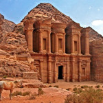
Other buildings converted to Christian churches include the Urn Tomb and al-Deir (Arabic for “the Monastery”).
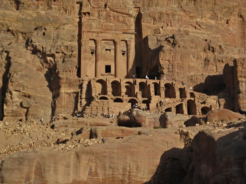
Urn Tomb at Petra (Chris Yunker)
The Urn Tomb, the first of the four Royal Tombs just north of the amphitheatre, still bears an inscription to “Christ the Saviour” on one of its inside walls.
Al-Deir, the biggest and most grandiose monument in Petra, is in the hills overlooking the city from the north-west. A visit involves a walk of about an hour from the city centre, up 800 rock-cut steps.
At 50 metres wide and 45 metres high, it is much bigger than al-Khazneh (“the Treasury”) — the famous monument that appears to visitors arriving through the gorge called the Siq (and in which the climax of the 1989 film Indiana Jones and the Last Crusade was set).
Originally cut out of the rock to serve as a mortuary temple, al-Deir was apparently later adapted to Christian use. It seems to have acquired its name of the Monastery from the crosses painted and inscribed on its inner walls.
Two Greek monks were recorded as living in the building in 1217.
Al-Deir, Petra’s biggest monument (Dennis Jarvis)
In biblical times Petra was a city of the Edomites, whose ancestor Esau settled there after he was tricked out of his rightful inheritance by his twin brother Jacob.
By the middle of the second century BC, the Edomites had been displaced by the Nabataeans. These former nomad herdsmen made Petra their multicoloured sandstone capital city, transforming it into a desert oasis by using ingenious aqueducts and cisterns to conserve water from flash floods.
The Nabataeans also controlled trade routes from Arabia to Mesopotamia and Syria, exacting high tolls from caravans which passed their way.
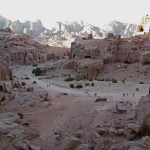
Overview of some of Petra’s monuments (Chris Yunker)
One tradition has the Three Wise Men buying their gold, myrrh and frankincense at Petra on their way to Bethlehem.
The greatest Nabataean king was Aretas IV (9 BC to AD 40), whose rule extended as far north as Damascus. His daughter Phasaelis was married to Herod Antipas, who divorced her to marry Herodias, his brother’s wife. Aretas IV then marched on Herod’s army, defeated it and captured territories along the West Bank of the Jordan River.
After his conversion, St Paul stays he spent time in “Arabia” (Galatians 1:17) — the name then given to the territory of the Nabateans — where he probably began his commission to preach the Gospel to pagans. It was Aretas IV who was pursuing him when Paul later escaped Damascus by being lowered in a basket from the city wall.
In AD 106 Petra was annexed by the Roman empire. Rome’s diversion of the caravan trade and some devastating earthquakes in subsequent centuries put the city into decline.
From the 13th century Petra was abandoned. It remained forgotten by the Western world until 1812 when a young Swiss explorer, Johann Ludwig Burckhardt, disguised as an Arab pilgrim, persuaded a local guide to take him there.
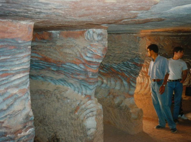
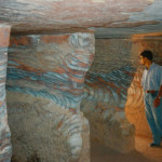
Pink sandstone cave at Petra (Seetheholyland.net)
Burckhardt’s published account inspired the English clergyman John William Burgon to write his prize-winning poem Petra, with its line “A rose-red city — half as old as Time!”
The poem, published in 1845, ran to 366 lines — much longer than the extract generally offered in anthologies.
Burgon, who later became dean of Chichester Cathedral, had never visited Petra when he composed his poem. He did so in 1862, describing it in a letter to his sister as “the most astonishing and interesting place I ever visited”. However, perhaps reflecting his ill health at the time, he added: “But there is nothing rosy in Petra by any means.”
Administered by: Petra Development and Tourism Regional Authority
Tel.: +962 (0)3 215-6020 (Visitors’ Centre)
Open: 6am-6pm (4pm in winter)
Jordan
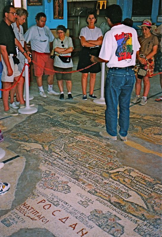
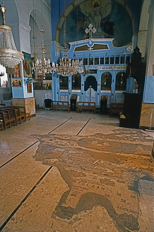
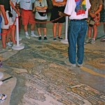
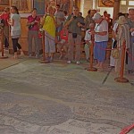
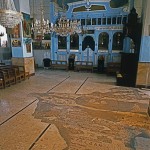
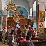
Guide explains mosaic map in Church of St George, Madaba (Seetheholyland.net)
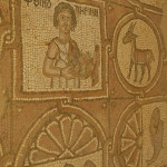
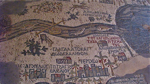
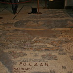
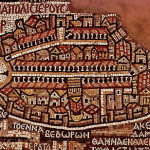
The remains of the oldest known map of the Holy Land, painstakingly assembled from more than a million pieces of coloured stone, lie on the floor of a church in the Jordanian city of Madaba.
This unique art treasure was designed by an unknown artist and constructed in a Byzantine cathedral in the middle of the 6th century.
It was rediscovered only in 1884, but its unique character was recognised only in 1896, after the new Greek Orthodox Church of St George had been built over it.
The discovery of the Madaba Mosaic Map, and mosaics in the remains of five more churches and other locations in the town, led to Madaba, 30km south of Amman, becoming known as “the City of Mosaics”.
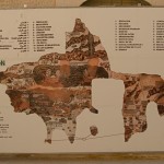
The map originally covered an area of more than 15.5 metres by 5.5 metres with a geographic sweep from Lebanon in the north to the Nile delta in the south. Less than a third of the map has survived.
In spite of some inaccuracies, it is regarded as the most exact map of the Holy Land before modern cartography was developed.
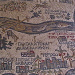
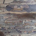
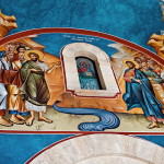
Madaba map showing fish in Jordan River (Dale Gillard)
Unlike modern maps, which face north, the Madaba mosaic is orientated to the east, with the Jordan River flowing from left to right.
Using a palette consisting of coloured stones and glass, the artist ingeniously depicted biblical locations, regional names and events, labelling them with about 150 inscriptions in Greek.
There is Jericho ringed with palm trees, Jacob’s Well at Shechem, the Oak of Mamre at Hebron, John’s baptism of Jesus in the Jordan River, and the allotments of the 12 tribes of Israel.
East of the Jordan River, a lion pursues a graceful gazelle. Fish swim down the river, with one turning back against the flow to avoid the poisonous Dead Sea. Two pulley-drawn ferries cross the river. Two boats cross the Dead Sea, one being rowed and the other under sail.
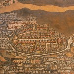
But the artist’s dominant focus is on the “Holy City” of Jerusalem. A lavish bird’s-eye view of the city is presented, with its walls, gates, main streets and 36 specific buildings represented. Many of the buildings (including the Church of the Holy Sepulchre) are clearly identifiable.
Scholars have differing opinions on why such an expensive piece of religious art should have been commissioned by Church authorities on the floor of a Christian building in a provincial town of the Roman Empire.
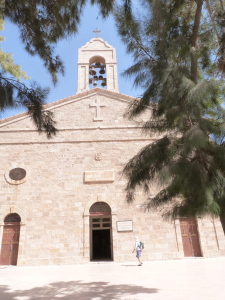
St George’s Church, Madaba (Seetheholyland.net)
Some of the possibilities debated are:
• To aid pilgrims in making their way from one holy place to another. But pilgrims could not take this map with them, and portable maps and local guides were available at the time.
• To represent Moses’ vision of the Promised Land. Moses glimpsed the Promised Land from the top of nearby Mount Nebo, and Madaba was the episcopal see of the bishopric to which Mount Nebo belonged.
• To enhance the spiritual experience of worshippers during liturgy. The mosaic was originally on the floor of a large church, stretching across between the priest at the altar and the congregation.
The contents of the map indicate that it was intended as a work of biblical geography, probably based on the Onomasticon of Eusebius, a gazatteer of placenames, as well as on pilgrims’ journals and the artist’s own knowledge of the land.
The importance given to Christian holy places, especially the Church of the Holy Sepulchre, rather than Old Testament locations, suggests that the map is a Christian exposition of the message of salvation in a geographic context.
Mosaic map in Church of St George (© Visitpalestine.ps)
Madaba was an important town in the early centuries of the Christian era. It was on the King’s Highway trade route, it had its own bishop and it had about 10 other churches with impressive mosaics. The remains of two of these churches are in the city’s archaeological park.
A conservative estimate is that the mosaic map would have originally contained about 1,116,000 pieces of stone and glass. A team of three workmen, working 10-hour days and directed by a superior artist, would have needed about 186 days to assemble it.
In 746, about 200 years after the mosaic map was constructed, Madaba was largely destroyed by an earthquake and subsequently abandoned.
The town was still in ruins and uninhabited in the early 1880s when a group of Christians from Karak, 140km south of Amman, decided to move there to escape conflict with Muslims in their home town.
The new settlers were removing debris from an old church in 1884, so they could build a new one on the site, when they discovered the remains of the map. They incorporated the surviving fragments into the new St George’s Church.
The map’s extraordinary value was not recognized until the librarian of the Greek Orthodox patriarchate in Jerusalem, Fr Kleopas Koikylides, visited in 1896. A report he published the following year brought international attention to the dusty village of Madaba.
By the middle of the 19th century the mosaic was in poor condition. Restoration and conservation was carried out by archaeologists Herbert Donner and Heinz Cüppers in 1965.
Madaba is now the fifth most populous city in Jordan and the administrative centre for the territory south of Amman. St George’s Church is northwest of the city centre.
Administered by: Greek Orthodox Church
Tel.: 962-5-324-4984
Open: Sat, Mon-Thur 8am-6pm; Fri 9.30am-6pm; Sun 10.30am-6pm (5pm closing in winter)
References
External links
Israel/Jordan
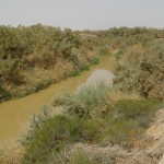
Jordan River near Chorazin (Seetheholyland.net)
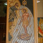
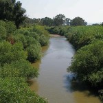
The Jordan River runs through the land and history of the Bible, giving its waters a spiritual significance that sets it aside from other rivers.
The Jordan is significant for Jews because the tribes of Israel under Joshua crossed the river on dry ground to enter the Promised Land after years of wandering in the desert.
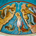
It is significant for Christians because John the Baptist baptised Jesus in the waters of the Jordan.
The prophets Elijah and Elisha also crossed the river dry-shod; and the Syrian general Naaman was healed of leprosy after washing in the Jordan at Elisha’s direction.
Excavated baptismal site at Bethany Beyond the Jordan (Seetheholyland.net)
Flowing southward from its sources in the mountainous area where Israel, Syria and Lebanon meet, the Jordan River passes through the Sea of Galilee and ends in the Dead Sea. A large part of its 320-kilometre length forms the border between Israel and Jordan in the north and the West Bank and Jordan in the south.
The river falls 950 metres from its source to the Dead Sea. For most of its course down the Jordan Rift Valley, it flows well below sea level. Its name means “Dan [one of its tributaries] flows down”.
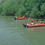
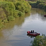
Though an old song says the River Jordan is “deep and wide”, the modern river is neither. In places it is more like a creek than a river — less than 10 metres across and 2 metres deep.
From Jesus’ time until the mid 20th century, seasonal flooding in winter and spring expanded its width to 1.5km. Dams in Syria, Jordan, Lebanon and Israel now preclude flooding.
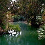
Yardenit baptism site (Seetheholyland.net)
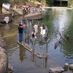
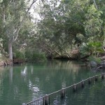
The place where Jesus was baptised by John the Baptist is believed to be in Jordan, on the east bank of a large loop in the river opposite Jericho.
A site less than 2km east of the river’s present course, at Wadi Al-Kharrar, has been identified as Bethany Beyond the Jordan. This is where John lived and baptised, and where Jesus fled for safety after being threatened with stoning in Jerusalem.
Until the 1994 peace treaty between Jordan and Israel, the area was a Jordanian military zone. After clearing nearby minefields, the Jordanian government has made the place accessible to archaeologists, pilgrims and tourists.
Jordan’s new Baptism Archaeological Park contains the remains of a Byzantine-era monastery featuring at least four churches, one of which is built around a cave believed to be the one that ancient pilgrims called “the cave of John the Baptist”.
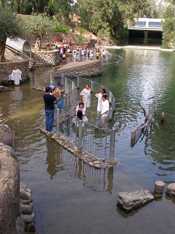
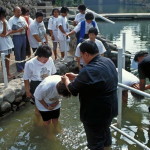
While the Jordanian location was inaccessible, a modern site commemorating Christ’s baptism was established at Yardenit in Israel, at the southern end of the Sea of Galilee.
Maintained by a kibbutz, it is a popular place for Christian pilgrims to renew their baptismal promises — or for new Christians to be baptised, often in white robes and undergoing total immersion in the mild waters of the Jordan.

The course of the Jordan River (Wikimedia)
Because its waters are a vital resource for the dry lands of the region, the Jordan has been a source of contention among Israel, Jordan, Syria, Lebanon and the Palestinians.
In modern times more than 90 per cent of its natural flow has been diverted for domestic and agricultural use. The lower Jordan is heavily polluted by sewage and industrial run-off.
In 2007 the World Monuments Fund listed the lower Jordan in the top 100 most “endangered cultural heritage sites”. In support, a regional environmental organisation, Friends of the Earth Middle East, said: “The region’s current policies treat the river as a backyard dumping ground.”
Related site:
In Scripture:
The Israelites cross the Jordan on dry ground: Joshua 3:14-17
Elijah crosses the Jordan on dry ground: 2 Kings 2:8
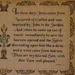
John baptises Jesus: Matthew 3:13-17; Mark 1:9-11; Luke 3:21-22; John 1:29-34
Naaman’s leprosy is cured in the Jordan: 2 Kings 5:1-14
References
External links
Israel/Jordan/West Bank
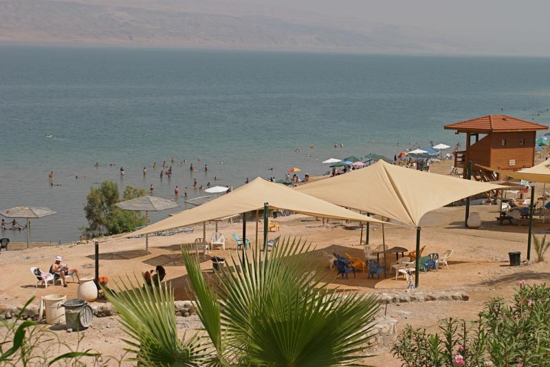
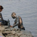
Bathers by the shore of the Dead Sea (© Tom Callinan / Seetheholyland.net)
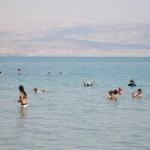
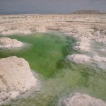
The Dead Sea, which shimmers like a blue mirror under all-day sunshine, is one of the most unusual bodies of water in the world.
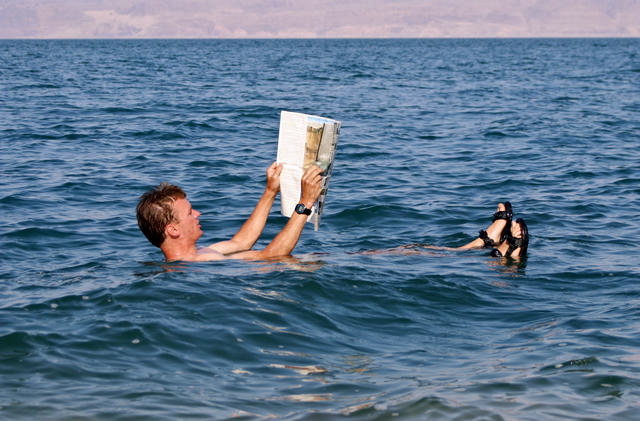
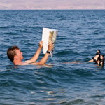
It is set in the lowest dry land on earth, so it has no outlet. It is so loaded with minerals that no fish can live in it. It is so dense that bathers can lie back on its surface and read a newspaper.
The Dead Sea is located about 25km east of Jerusalem, along the border between Israel and Jordan. About half of it is actually in Jordanian territory.
The ancient Hebrews called this body of water the Sea of Salt. Other ancient names include the Sea of Solitude, the Sea of Arabah and the Asphalt Sea. The Crusaders called it the Sea of Satan.
The Dead Sea’s therapeutic qualities attracted Herod the Great. Its minerals and sticky black mud provided balms for Egyptian mummies and cosmetics for Cleopatra.
Now its health resorts treat psoriasis and arthritis, its skin-care products are marketed worldwide, and its industrial evaporation pans harvest potash and other minerals.
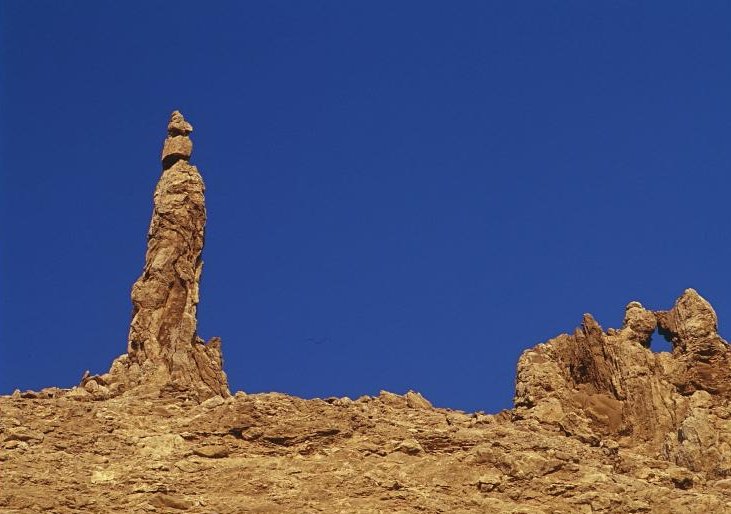
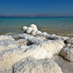
Pillar of salt, on Jordanian side of Dead Sea, known as Lot’s Wife (© Visitjordan.com)
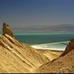
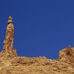
The region has many biblical connections. Here, though their locations are unknown, the wicked cities of Sodom and Gomorrah were destroyed by God with “sulphur and fire” and Lot’s wife was turned into a pillar of salt for looking back at the destruction (Genesis 19:24-26). Among the salt encrustations around the sea is an unusual column at the southern end called Lot’s Wife (though it is 20 metres high).
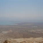
On the eastern side, the highest peak visible is Mount Nebo, where Moses glimpsed the Promised Land. Further south stands the fortress of Machaerus, where Herod Antipas imprisoned and then executed John the Baptist.
On the western side, from north to south, are Qumran, where the Dead Sea Scrolls were found; Ein Gedi, where David hid from King Saul in a cave (and cut off a corner of the king’s cloak when he entered the cave to relieve himself); and Herod the Great’s fortress of Masada.
Afloat in the Dead Sea (David Niblack)
By 2013 the Dead Sea was 50km long, 15km across at its widest point, and 430 metres below sea level. Its area was constantly shrinking and the water level was dropping by more than a metre a year.
Because it has no exit, water is lost only through evaporation, which leaves behind the minerals. The Dead Sea is nearly 10 times as salty as the open seas. The high concentration of minerals (predominantly magnesium chloride) provides the buoyancy that keeps bathers suspended — as well as a bitter taste.
A low promontory of land called el-Lisan (“the tongue”) projects across the sea from the east, dividing the southern third from the northern section. The southern part is now devoted to evaporation pools for mineral extraction.
Most of the water that once flowed from the Jordan River into the Dead Sea is being diverted for drinking water and agricultural purposes, so there is not enough to offset the high evaporation rate.
Since the late 1980s the landscape around the sea has been reshaped by thousands of sinkholes — caused by fresh water from the mountains dissolving underground levels of salt. This phenomenon has caused some tourist beaches in Israel to close.
Rescue proposals to prevent the sea drying up have included canals to bring water from the Mediterranean Sea or the Red Sea.
If the Dead Sea becomes rejuvenated with fresh water, this could fulfil a prophecy in Ezekiel 47:8-10, that it will “become fresh . . . and there will be very many fish”.
In December 2013, representatives of Israel, Jordan and the Palestinian Authority agreed on a long-term desalination project in which brine would be piped about 180 kilometres from Aqaba, Jordan, to replenish the Dead Sea.
Related sites:
In Scripture:
God destroys Sodom and Gomorrah: Genesis 19:24-26
Prophesy that the Dead Sea will become fresh: Ezekiel 47:8-10
References
External links
Jordan
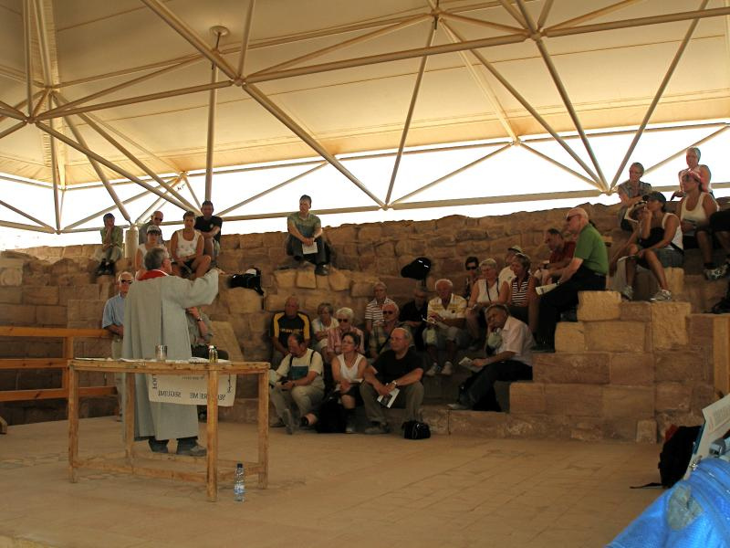
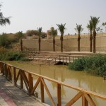
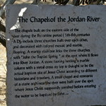
The baptism of Jesus by John the Baptist, the act that launched Jesus’ public ministry, most likely took place on the Jordanian side of the Jordan River, in a perennial riverbed called the Wadi Al-Kharrar.
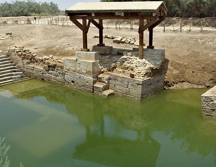
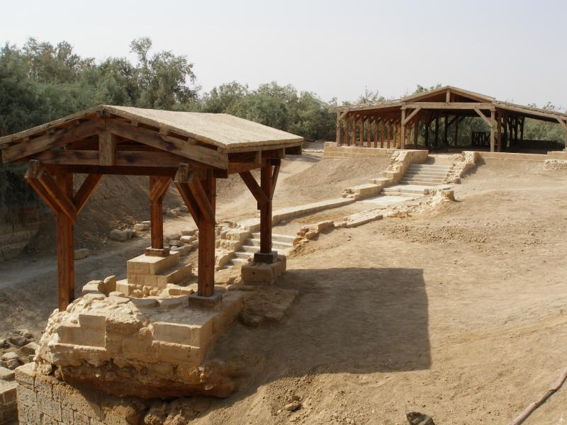
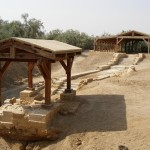
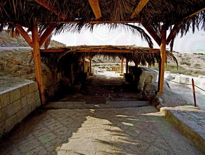
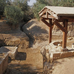
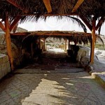
Shelter over remains of a church at the Baptism Site (Alicia Bramlett)
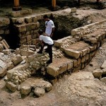
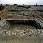
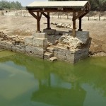
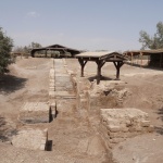
Here the remains of more than 20 Christian sites have been discovered, including several churches, a prayer hall, baptismal pools and a sophisticated water reticulation system. These date back to the Roman and Byzantine periods.
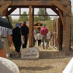
Excavations at Bethany Beyond the Jordan began only in 1996. Before then the area had been a minefield on the front line between Jordan and Israel, whose border is the Jordan River.
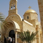
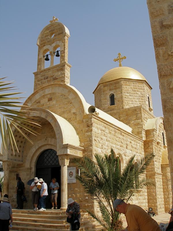
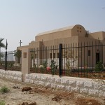
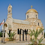
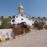
The 1994 peace treaty between Jordan and Israel prepared the way for access by archaeologists and church officials. Jordanian authorities have built a new road, a visitors’ centre and walkways. Several Christian denominations have built churches, the most prominent being the gold-domed Greek Orthodox Church of St John the Baptist.
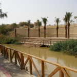
The baptismal site of Bethany Beyond the Jordan (John 1:28) is near the southern end of the Jordan River, across from Jericho and 8 kilometres south of the King Hussein (or Allenby) Bridge. It is 40 minutes by car from the Jordanian capital of Amman.
It should not be confused with the Bethany on the eastern slope of the Mount of Olives, near Jerusalem, where Jesus raised Lazarus from the dead.
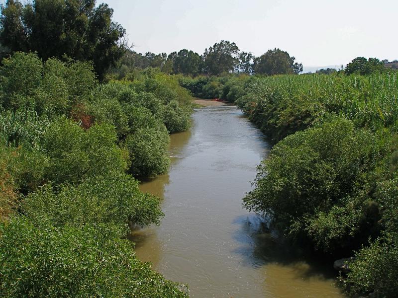
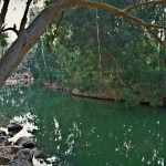
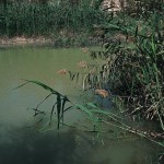
At the head of the Wadi Kharrar, springs emerge from the barren landscape to create a small oasis of tamarisk and palm trees, reeds, grasses and shrubbery. From here the Wadi Kharrar stream flows eastward to the Jordan River, its 2-kilometre route flanked by thick vegetation and identified by the murmur of running water.
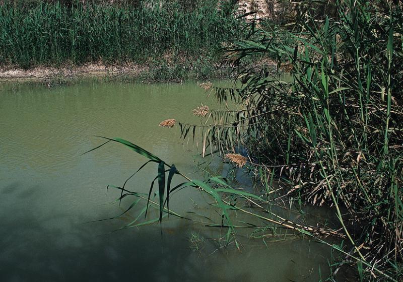
Lush vegetation beside the Jordan River (© Visitjordan.com)
The fresh water of the Wadi Kharrar stream would have been more suitable for baptisms than the murkier Jordan River, which in John the Baptist’s time was also subject to heavy seasonal flooding.
The area adjacent to the baptismal site of Bethany Beyond the Jordan (called Al-Maghtas in Arabic) has many other biblical associations.
Near here, it is believed, Joshua led the Israelites across the Jordan River to the Promised Land after the waters miraculously stopped flowing (Joshua 3:14-16).
Elijah — a prophet who is often associated with John the Baptist — also crossed the Jordan River on dry ground in this area, and was then taken up to heaven in a chariot of fire (2 Kings 2:8-11).
In the New Testament, Jesus withdrew to Bethany Beyond the Jordan after being threatened with stoning in Jerusalem (John 10:31-40).
Early Christian pilgrims visited Bethany Beyond the Jordan on a route that went from Jerusalem to Jericho, across the Jordan River and then to Mount Nebo.
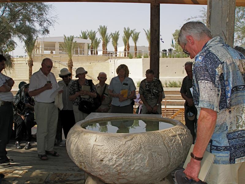
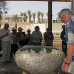
Pilgrims renew baptismal promises around a font of water from the Jordan River (Seetheholyland.net)
John the Baptist “went into all the region around the Jordan, proclaiming a baptism of repentance for the forgiveness of sins” (Luke 3:3). The Jordan River has changed course over the centuries and the precise spot where John baptised Jesus will probably never be positively identified.
All four Gospel writers mention Jesus’ baptism, but only John specifies the location as Bethany Beyond the Jordan. Documentary evidence favours identifying this location as Wadi Al-Kharrar or Al-Maghtas.
Not all scholars accept this identification. Some prefer a location north of the Sea of Galilee, by the Yarmouk River, where Elijah, hiding from the wrath of King Ahab, is believed to have been fed by a raven (1 Kings 17:2-6).
Identification was made more difficult by the Christian scholar Origen, who lived in Palestine in the 3rd century. Unaware of any Bethany on the east side of the Jordan River, he suggested the placename in John’s Gospel should be Bethabara (which was on the west of the river). Some New Testament translators followed his suggestion. It even appears in the King James Version of the Bible.
Jesus’ baptism is also commemorated on the western bank of the Jordan River, at a site in Israel called Qasr Al-Yahud (see below).
Pilgrims as far back as 333 described visits to the baptism site of Bethany Beyond the Jordan. An account in 530 said it was marked by a marble pillar on which an iron cross had been fastened.
The 6th-century pilgrim Theodosius described a church built there by the Byzantine emperor Anastasius I. He said this square-shaped church was built on high arches to allow flood waters to pass underneath. Archaeologists believe they have uncovered remains of the piers on which the church was built.
Later pilgrims referred to a small church said to have been built “on the place where the Lord’s clothes were placed”.
The Wadi Al-Kharrar was also the centre of an active monastic life. Hermits lived in caves carved into the soft limestone, gathering weekly for a common liturgy.
A monastery with four churches developed between the 4th and 6th centuries on Tell Mar Elias (St Elijah Hill), just above the springs that feed the stream. A hostel between the monastery and the river provided lodging for pilgrims, who would immerse themselves in the waters.
The baptismal site was particularly revered by Russian pilgrims prior to the Russian Revolution of 1917. They would arrive carrying their shrouds which they would wear as they baptised each other in the river.
In an area of several square kilometres, now called the Baptism Archaeological Park, the Jordanian Department of Antiquities has surveyed, excavated and conserved a series of ancient remains.
Mosaics from a church floor (© Visitjordan.com)
These include a walled monastery containing at least four churches and chapels, a prayer hall, a sophisticated water reticulation and storage system and three plastered pools. The wall was intended to prevent erosion, rather than protect against attack.
The discoveries include remains of foundations and walls, mosaic floors, fine coloured stone pavements, Corinthian capitals, column drums and bases, and hermits’ cells and caves.
One of the churches appears to have been built around a natural cave containing fresh spring water — possibly the cave that Byzantine pilgrims called “the cave of John the Baptist”.
The development of facilities for pilgrims has been encouraged by the Jordanian royal family. These facilities include a new road from the Dead Sea area, a visitors’ centre, and paths and walkways to the most important religious and archaeological sites.
In 2015 Bethany Beyond the Jordan was designated a World Heritage site.
Greek Orthodox Church of St John the Baptist at Bethany Beyond the Jordan (Seetheholyland.net)
The religious sites in the Wadi Al-Kharrar area were gradually abandoned from the time of the Muslim conquest, in the middle of the 7th century. Pilgrims from Jerusalem no longer ventured across the Jordan River, so they commemorated the baptism of Jesus near Qasr Al-Yehud on the western bank.
This site is marked by the large medieval-era Greek Orthodox Monastery of St John the Baptist, built on Byzantine ruins and clearly visible from across the river.
Access to the area around Qasr Al-Yehud has also been difficult in modern times. From 1967 until 1994 it was also in a military zone and heavily mined. It was open only twice a year for pilgrims celebrating their feasts of the baptism of Christ, in January for the Orthodox and October for the Catholics. In 2011 it was opened to the public.
By the end of 2018, access to three of the seven monasteries in the area — Greek Orthodox, Ethiopian and Franciscan (Catholic) — had been cleared of mines.
While Qasr Al-Yehud was inaccessible, the long-established Kibbutz Kinneret began running a substitute site at Yardenit, near the southern end of the Sea of Galilee, with modern facilities and shady eucalyptus trees. It has been receiving more than half a million visitors a year, many receiving baptism or renewing their baptismal promises in the Jordan River.
In Scripture:
Elijah is taken up to heaven: 2 Kings 2:1-14
The preaching of John the Baptist: Luke 3:2-14
John baptises Jesus: Matthew 3:13-17; Mark 1:9-11; Luke 3:21-22; John 1:29-34
The witness of John the Baptist: John 1:19-28
Jesus retreats beyond the Jordan for safety: John 10:40
Administered by:
Department of Antiquities of Jordan; Jordan Valley Authority; Greek Orthodox Church
Tel.: 962-5-3590360
Open: Winter 8am-4pm (last entry 3pm); summer 8am-6pm (last entry 5pm)


References
External links
Jordan
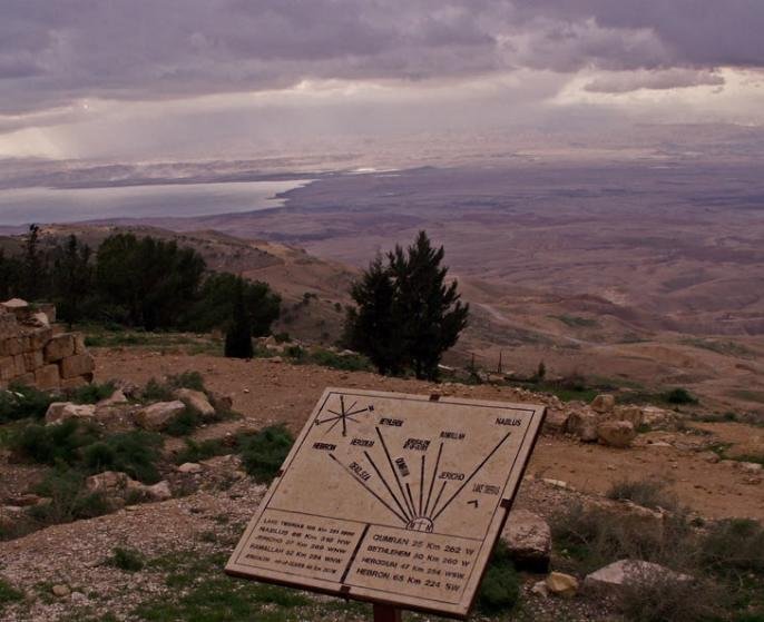
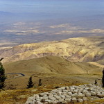
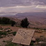
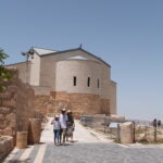
View from Mount Nebo (© Custodia Terrae Sanctae)
After 40 years leading the headstrong Israelites in the desert, Moses stood on the windswept summit of Mount Nebo and viewed the Promised Land of Canaan — after having been told by God “you shall not cross over there”.
On a clear day, today’s pilgrims can see the panorama Moses viewed: The Dead Sea, the Jordan River valley, Jericho, Bethlehem and the distant hills of Jerusalem.
As Deuteronomy 34:5-6 recounts, Moses died there in the land of Moab “but no one knows his burial place to this day”. Moses did, however, eventually reach the Promised Land. He and Elijah were seen with Jesus at the latter’s Transfiguration (Luke 9:28-36).
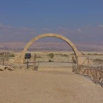
Mount Nebo is now in western Jordan. At 820 metres high, it looks down 1220 metres on the nearby Dead Sea (which is about 400 metres below sea level).
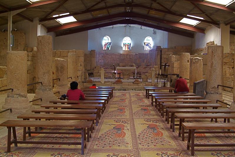
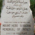
Early Christians from Jerusalem made it a place of pilgrimage. In the 3rd or 4th century monks from Egypt built a small church on one of its peaks, Siyagha (a name meaning monastery), to commemorate the end of Moses’ life. By the end of the 4th century, an empty “tomb of Moses” was being shown to pilgrims on the mountain.
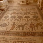
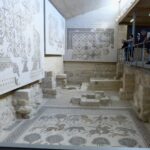
Floor mosaics in Mount Nebo Church (© Visitpalestine.ps)
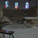
The monks’ church was expanded in the 5th and 6th centuries into a large basilica with a stunning collection of Byzantine mosaics and an elaborate baptistry. Though little remains of the early buildings, the mosaics can be seen inside the present-day shrine.
The main mosaic, about 9 metres by 3 metres, depicts monastic wine-making, hunters and various animals.
In the 1930s the Mount Nebo site was excavated, thanks largely to a description of it in the journal of an early woman pilgrim, Egeria, in AD 394. Six tombs were also found, hollowed into the rock beneath the basilica’s mosaic floor.
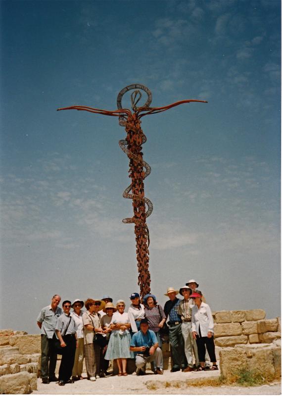
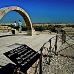
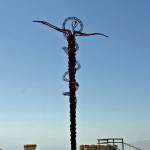
Pilgrims at Mount Nebo’s serpentine cross sculpture (Seetheholyland.net)
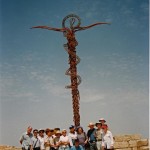
Outside the present-day shrine stands an enigmatic serpentine cross, the Brazen Serpent Monument. Created by Italian artist Giovanni Fantoni, it imaginatively merges the life-saving bronze serpent set up by Moses into the desert (Numbers 21:4-9) and the cross upon which Jesus was crucified.
A less well-known site is at Khirbet al-Mukhayyat, a small town to the east, between Mount Nebo and Madaba. Here are the remains of the village of Nebo, mentioned twice in the Bible, where villagers in the 6th and 7th centuries constructed several churches.
On the highest point of the acropolis was the 6th-century Church of St George. The best-preserved floor mosaics are in the Church of Sts Lot and Procopius, who were venerated as martyrs.
In Scripture:
Moses on Mount Nebo: Deuteronomy 34:1-8
Transfiguration of Jesus: Luke 9:28-36
Administered by: Franciscan Custody of the Holy Land
Tel.: 962-5-325-2938
Open: 8am-5pm (4pm Oct-Mar)

References
External links