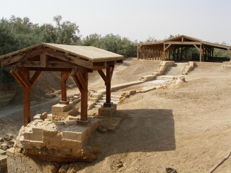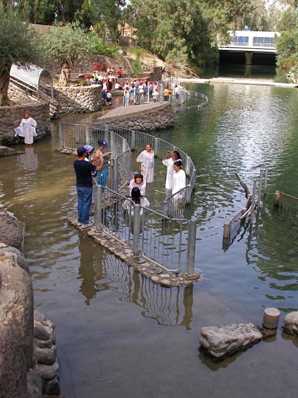
Jordan
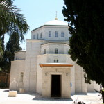
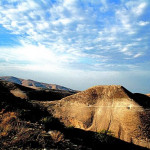
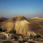
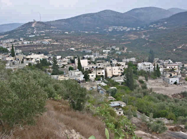
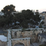
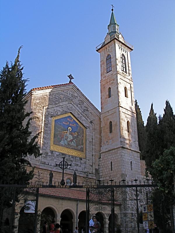
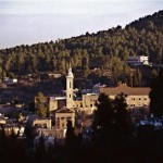
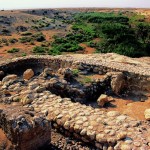
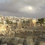
Jerash, one of the largest and best-preserved Roman cities in the Middle East, lies in a broad valley among the biblical mountains of Gilead, about 50 kilometres north of the Jordanian capital, Amman.
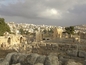
Ruins of ancient Jerash with modern city in the background (Britchi Mirela / Wikimedia)
Under the name of Gerasa, it was one of the 10 cities of the Decapolis. This league of Greek cities, which came under Roman control in the 1st century BC, is mentioned in the New Testament.
People from the predominantly pagan Decapolis followed Jesus during his ministry in Galilee (Matthew 4:23-25). Although Jesus visited the region (Mark 7:31), there is no evidence that he entered Gerasa.
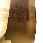
The city became Christian in the Byzantine period, when its 25,000 inhabitants had more than 20 churches and bishops who took part in early Church councils. Ruins of most of the churches can still be seen.
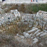
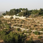
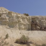
Conquests by Persians and Muslims in the 7th century, followed by devastating earthquakes in the 8th century, caused the city to be abandoned. It was rediscovered only at the beginning of the 19th century, remarkably preserved after being buried in sand for centuries.
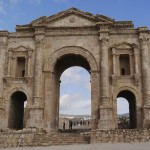
Triumphal arch stands outside city
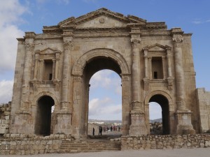
Hadrian’s Arch (Zairon / Wikimedia)
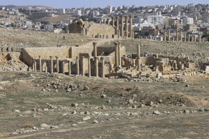
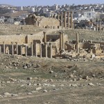
Jerash is divided by the Wadi Jerash, with the ancient city on the west side of the valley and the modern city — dating from the first half of the 20th century — on the east.
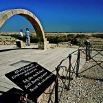
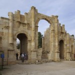
Outside the ancient city’s South Gate stands a grand triumphal arch with three openings, built to mark a visit by the emperor Hadrian in AD 129-130.
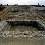
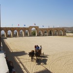
Adjacent to this is a hippodrome, constructed in the 2nd century for horse and chariot races, with a seating capacity of 15,000.
This 245-metre by 52-metre arena is now the venue for the twice-daily (except Tuesdays) Roman Army and Chariot Experience, in which authentically dressed actors perform as legionaries, gladiators and chariot drivers.
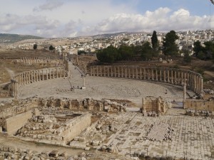
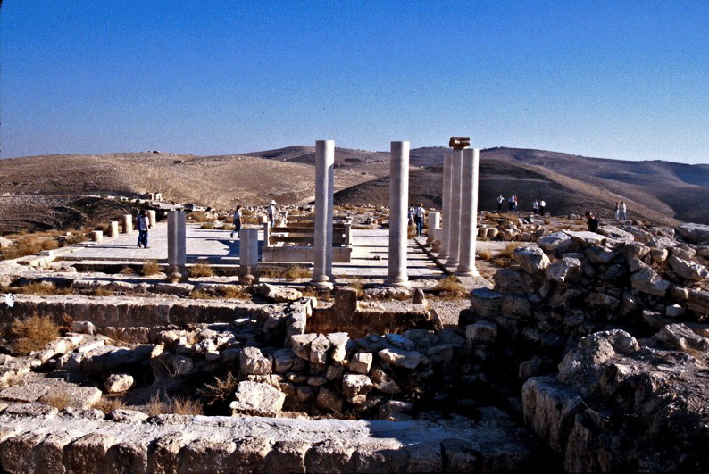
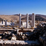
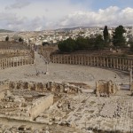
Oval Plaza at Jerash (Zairon / Wikimedia)
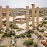
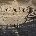
Inside the ancient city, the Temple of Zeus at the south end of the cardo overlooks a vast colonnaded Oval Plaza that served as Jerash’s forum. Nearby is the South Theatre, seating more than 3000 spectators and still in use.
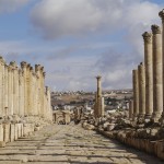
The main street, the Cardo Maximus, extends for 800 metres in a northerly direction from the Oval Plaza.
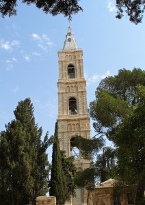
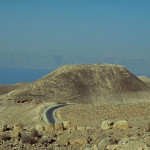
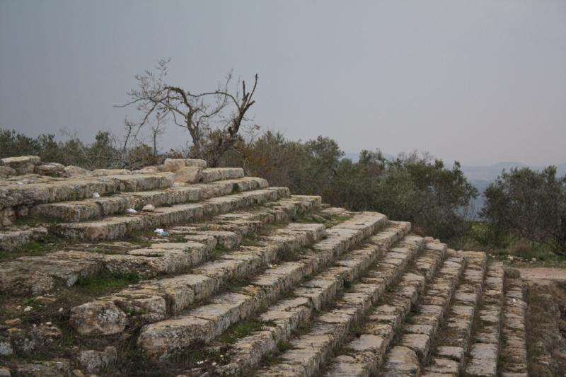
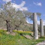
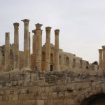
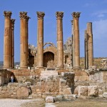
Halfway along the Cardo, a monumental staircase leads to an esplanade with the remains of an open-air altar. Beyond are the tall Corinthian columns of the hilltop Temple of Artemis, which dominated the city. To the right is the North Theatre.
An abundance of churches
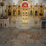
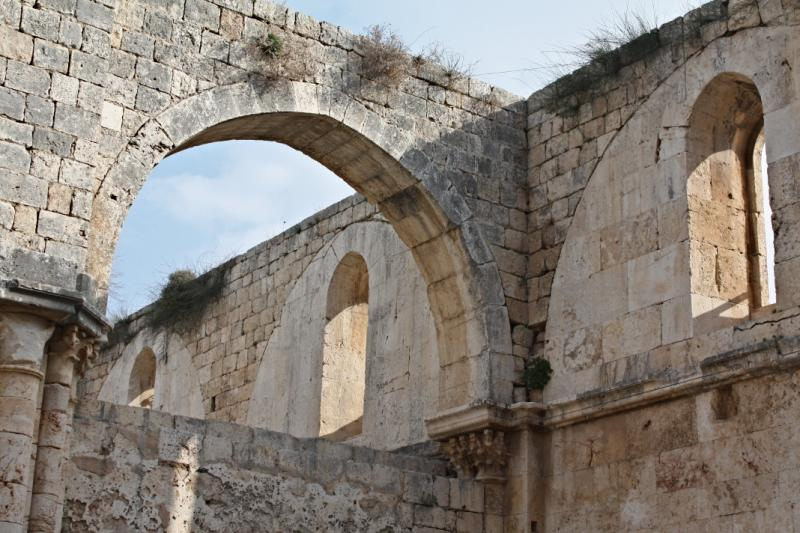
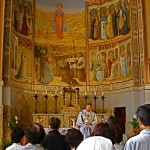
Jerash had more than 20 churches, all built between AD 368 and AD 611, with some even sharing walls. Their abundance may be due to a practice of the Byzantine Church — still the custom in some Eastern churches — to permit only one eucharistic service at each altar every day.
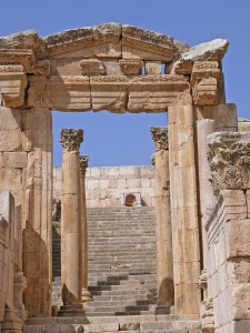
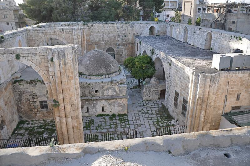
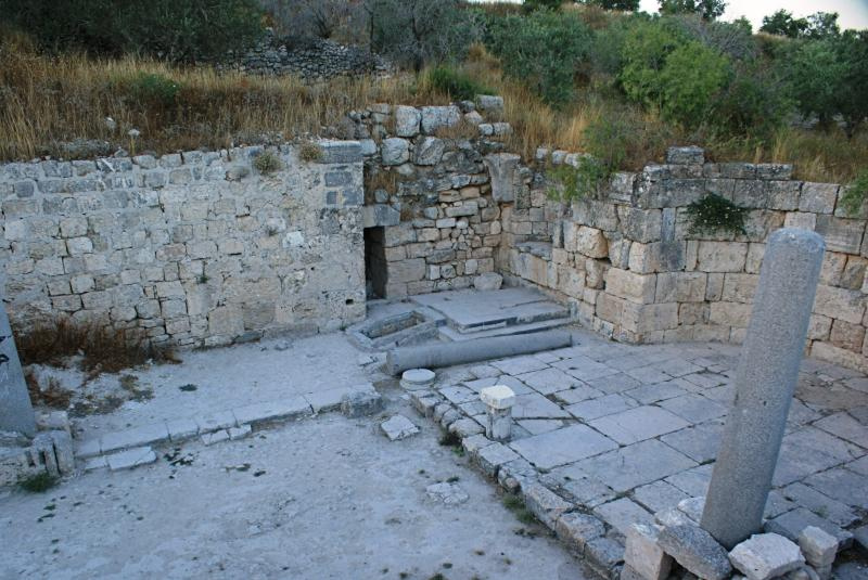
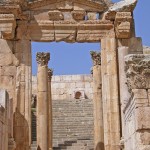
Gateway to the Roman temple which was rebuilt as the church now called the Cathedral (Dennis Jarvis)
Most of the ruined churches are to the west of the Cardo Maximus, between two side streets, the South Decumanus and the North Decumanus. They include:
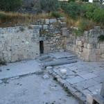
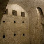
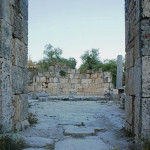
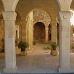
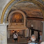
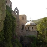
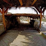
• The so-called Cathedral (though there is no evidence that it was the seat of the bishop). The oldest church in Jerash, it was built on the ruins of a Roman temple, on the southern side of the esplanade leading to the Temple of Artemis.
Its outdoor atrium contains a small pool, believed to have been filled with wine when the miracle at the wedding in Cana was celebrated.
Against an outer east wall is a shrine dedicated to the Virgin Mary, with an inscription mentioning Mary and the archangels Michael and Gabriel.
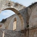
• The Church of St Theodore is to the west of the cathedral, and on a higher level.
An inscription that was over the main door reads: “The one passing by this place used to close his nose because of the bad smell; today he raises his right hand and draws the sign of the Holy Cross.” This is probably a reference to the sacrifices previously burnt on the nearby altar in front of the Temple of Artemis.
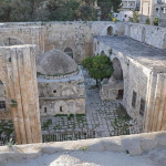
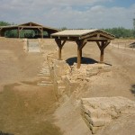
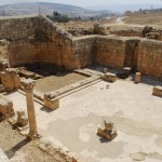
General view of the Church Complex (Fadi Shawkat Haddad)
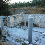
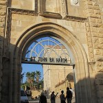
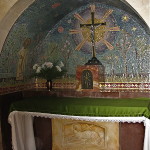
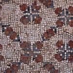
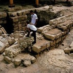
• The Church Complex, west of the Church of St Theodore, has three adjoining churches that share an atrium. All were built between AD 529 and AD 533.
The Church of St George, on the south side, was still in use in the 8th century, when its mosaics were destroyed by iconoclasts opposed to the representation of humans and animals.
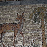
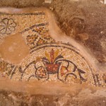
The mosaic floor of the Church of St John the Baptist, in the middle, is also damaged, but images can be seen of the four seasons, plants and animals, and the Egyptian cities of Alexandria and Memphis.
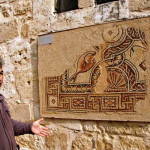
The Church of Sts Cosmas and Damian, twin brothers who were doctors, is on the north side. Its mosaic floor, the most splendid in Jerash, has survived. Besides gazelles, rabbits, peacocks, sheep and other animals, the images include the churchwarden Theodore and his wife Georgia, praying with outspread arms.
• West of the Church Complex is the Church of St Genesius, built in AD 611 — just three years before the Persian invasion that was the beginning of the end for Jerash.
Tel.: 962 2 635-1272 (Visitors’ Centre)
Open: Apr-Oct 8am-6pm; Nov-Mar 8am-5pm. Last entry to site one hour before closing time.
-
- Gateway to the Roman temple which was rebuilt as the church now called the Cathedral (Dennis Jarvis)
-
- Ruins of ancient Jerash with modern city in the background (Britchi Mirela / Wikimedia)
-
- Hadrian’s Arch (Zairon / Wikimedia)
-
- South Gate at Jerash (Berthold Werner / Wikimedia)
-
- Jerash city walls (© Visit Jordan)
-
- Chariot in Jerash hippodrome (Jean Housen / Wikimedia)
-
- Cardo Maximus at Jerash, looking north (Zairon / Wikimedia)
-
- Temple of Zeus at Jerash (Berthold Werner / Wikimedia)
-
- Oval Plaza at Jerash (Zairon / Wikimedia)
-
- South Theatre at Jerash (Zairon / Wikimedia)
-
- Temple of Artemis at Jerash (Dennis Jarvis / Wikimedia)
-
- Looking from the Church of St Theodore down into the Cathedral (Verity Cridland)
-
- General view of the Church Complex (Fadi Shawkat Haddad)
-
- Church of Sts Cosmas and Damian at Jerash (Jean Housen / Wikimedia)
-
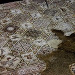
- Mosaic floor in Church of Sts Cosmas and Damian (Michael Gunther / Wikimedia)
-
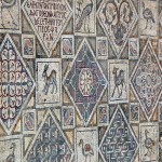
- Part of the mosaic floor in the Church Complex at Jerash (Dennis Jarvis)
References
Bourbon, Fabio, and Lavagno, Enrico: The Holy Land Archaeological Guide to Israel, Sinai and Jordan (White Star, 2009)
Caffulli, Giuseppe: “Jerash, Pompeii of the East”, Holy Land Review, spring 2010
Dyer, Charles H., and Hatteberg, Gregory A.: The New Christian Traveler’s Guide to the Holy Land (Moody, 2006)
Freeman-Grenville, G. S. P.: The Holy Land: A Pilgrim’s Guide to Israel, Jordan and the Sinai (Continuum Publishing, 1996)
Haddad, Fadi Shawkat: A Christian Pilgrimage Journey in Jordan (published by author, PO Box 135, Amman 11733, 2015)