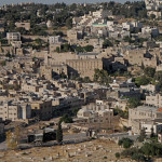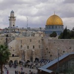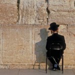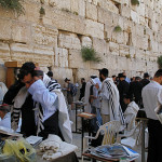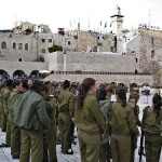
Jerusalem
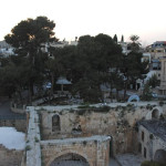
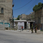
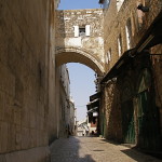
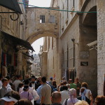
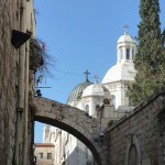
Thousands of pilgrims each year walk under the Ecce Homo Arch near the beginning of the Via Dolorosa without realising that extensive remains of first-century Jerusalem lie beneath their feet.
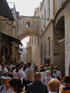
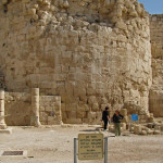
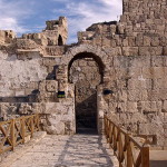
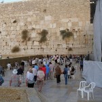
Looking westward to Ecce Homo Arch, with Sisters of Zion convent at right (Seetheholyland.net)
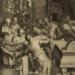
For centuries Christians believed the arch was the place where Pontius Pilate displayed Jesus — beaten, crowned with thorns and clothed in a purple robe — to a hostile Jerusalem crowd with the words: “Behold the man” (“Ecce Homo” in Latin).
This belief persists in many publications, though archaeology has proved the arch did not exist then.
Archaeologists say the arch stood on a great plaza constructed by the emperor Hadrian when he rebuilt the city in AD 135 — a century after Jesus was crucified. Some consider it was originally a city gate from the time of Herod Agrippa I (AD 41-44).
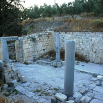
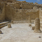
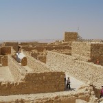
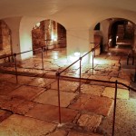
Large sections of the plaza remain underneath the Via Dolorosa and adjacent buildings, accessible through the Ecce Homo convent of the Sisters of Zion.
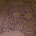
The Roman flagstones of Hadrian’s plaza were once thought to be the Stone Pavement (Lithostrotos in Greek, Gabbatha in Aramaic) identified in John’s Gospel as the location where Jesus was condemned by Pilate. But it is more likely that Pilate judged Jesus at Herod the Great‘s palace, on the site of the modern Citadel inside the Jaffa Gate.
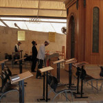
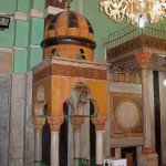
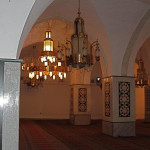
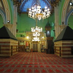
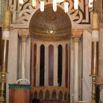
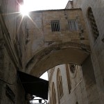
Arch continues into convent chapel
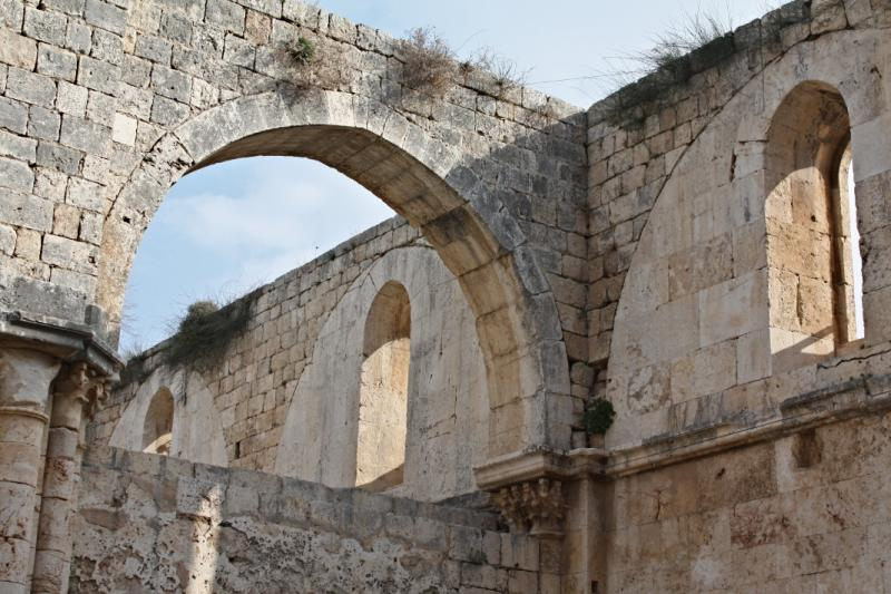
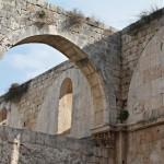
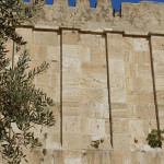
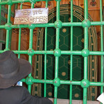
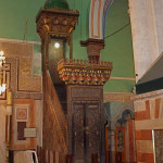
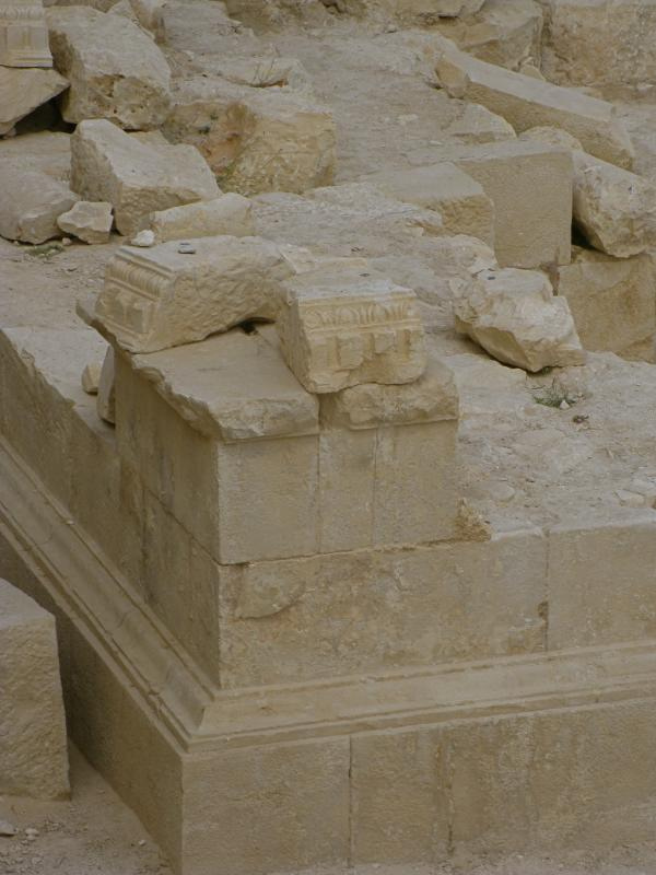
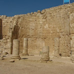
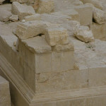
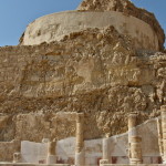
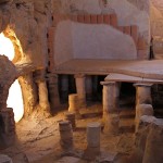
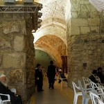
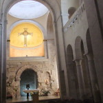
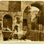
Built in the style of a triumphal arch, the Ecce Homo Arch is the central span of what was originally a triple-arched gateway. It supports a small room with barred windows.
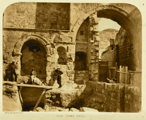
Ecce Homo Arch in 1864 (James McDonald, Ordnance Survey of Jerusalem)
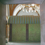
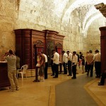
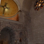
The arch continues through the wall of the convent chapel, where the smaller northern arch now frames the tabernacle, under a Byzantine cross on a gilded mosaic backdrop. The southern arch has been destroyed.
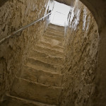
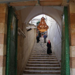
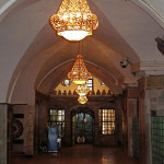
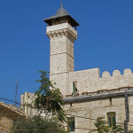
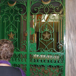
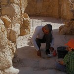
Entry to the convent, and the extensive remains and small museum beneath it, is through a door near the corner of the Via Dolorosa and a narrow alley called Adabat er-Rahbat, or The Nuns Ascent.
The convent was built in 1857 by Marie-Alphonse Ratisbonne, a Frenchman who converted to Catholicism from Judaism and became a priest.
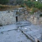
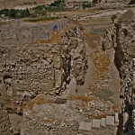
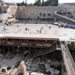
During construction the pavement of Hadrian’s plaza was uncovered. It also extends under the Church of the Flagellation and the Church of the Condemnation at the First and Second Stations of the Via Dolorosa.
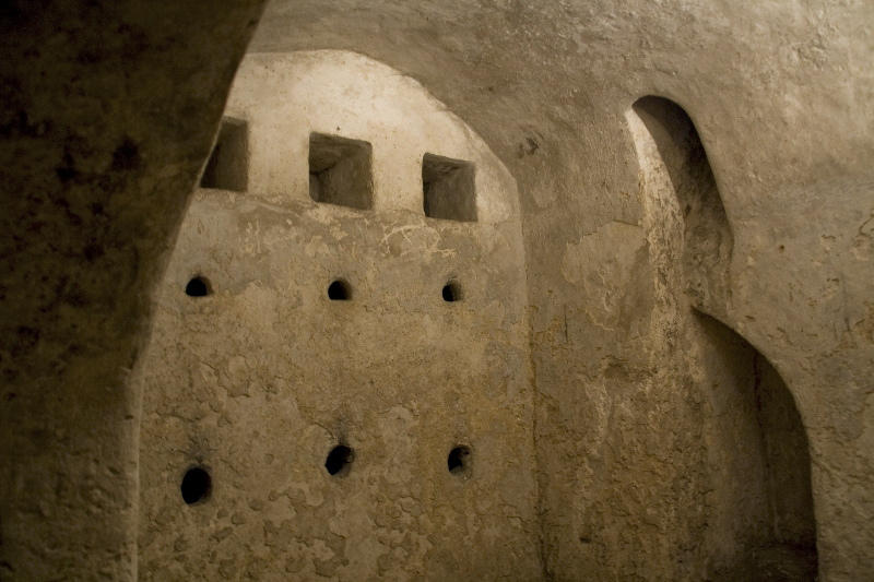
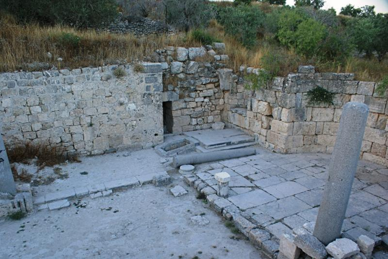
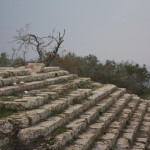
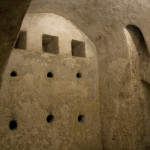
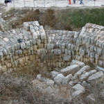
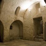
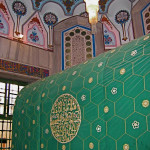
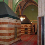
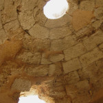
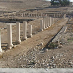
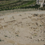
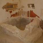
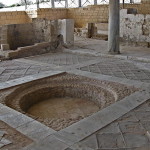
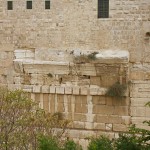
Down several steps beneath the plaza is a large cistern hewn out of the rock. It is about 54 metres long and 14 metres wide, with a depth of around 5 metres.
It was originally an open-air pool, part of a chain of reservoirs providing water for the citizens of Jerusalem. The historian Josephus says the name of the pool was Struthion (meaning sparrow). Hadrian installed impressive vaulting over the pool to enable his plaza to cover it.
Soldiers carved games into flagstones
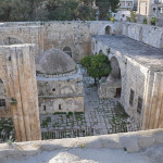
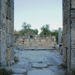
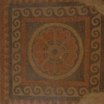
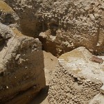
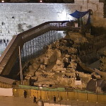
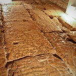
The flagstones of the plaza offer an intriguing insight into the lives of the Roman soldiers garrisoned at the nearby Antonia fortress, built by Herod the Great to overlook — and control — the Temple.
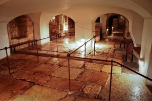
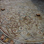
Hadrian’s plaza, called the Lithostrotos, under the Ecce Homo convent (© Stanislao Lee / Custodia Terrae Sanctae)
Named after Herod’s patron Marc Antony, this vast fortress was a symbol of the Roman domination of the city.
In various parts of the pavement, off-duty soldiers carved the lines and squares of the games they played in idle moments. Other parts of the plaza were grooved to prevent horses from slipping.
One set of marks, with a crude crown and the initial B in the centre (for basileus, the Greek word for king), has been identified as the King’s Game, which soldiers played with dice.
In the past, the presence of the soldiers’ games added weight to the mistaken assumption that this was the location where Jesus appeared before Pilate, was flogged, mocked as “King of the Jews” and crowned with thorns.
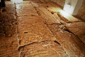
Grooves cut into flagstones to stop horses slipping (© Stanislao Lee / Custodia Terrae Sanctae)
Though the Ecce Homo Arch and Hadrian’s plaza have no proven link with Jesus or Pilate, the area has a definite connection to St Paul.
After Paul was seized by Jews from Asia while visiting the Temple, it was from the Antonia fortress that soldiers ran to rescue him and prevent a riot. And it was on the steps leading to the fortress that Paul addressed the crowd and avoided being flogged by announcing to a surprised tribune that he was a Roman citizen.
Related site:
In Scripture:
Jesus before Pilate: John 18:28-19:16
Paul addresses the Jerusalem crowd: Acts 21:27-22-29
Ecce Homo Convent
Administered by: Sisters of Our Lady of Zion and the Chemin Neuf Community
Tel.: +972 (0)2 627 72 92
Open: 8am-5pm
-
- Looking eastward to Ecce Homo Arch (Seetheholyland.net)
-
- Looking westward to Ecce Homo Arch, with Sisters of Zion convent at right (Seetheholyland.net)
-
- Close-up of Ecce Homo Arch, looking westward (Seetheholyland.net)
-
- Church of the Condemnation, with Ecce Homo Arch in distance (Djampa)
-
- Chapel of Ecce Homo convent, with continuation of arch faintly visible in centre of picture (Dror Feitelson / PikiWiki Israel)
-
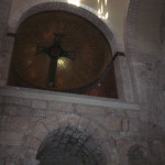
- Byzantine cross above northern arch of trip-arched gateway (Zehnfinger)
-
- Hadrian’s plaza, called the Lithostrotos, under the Ecce Homo convent (© Stanislao Lee / Custodia Terrae Sanctae)
-
- Grooves cut into flagstones to stop horses slipping (© Stanislao Lee / Custodia Terrae Sanctae)
-
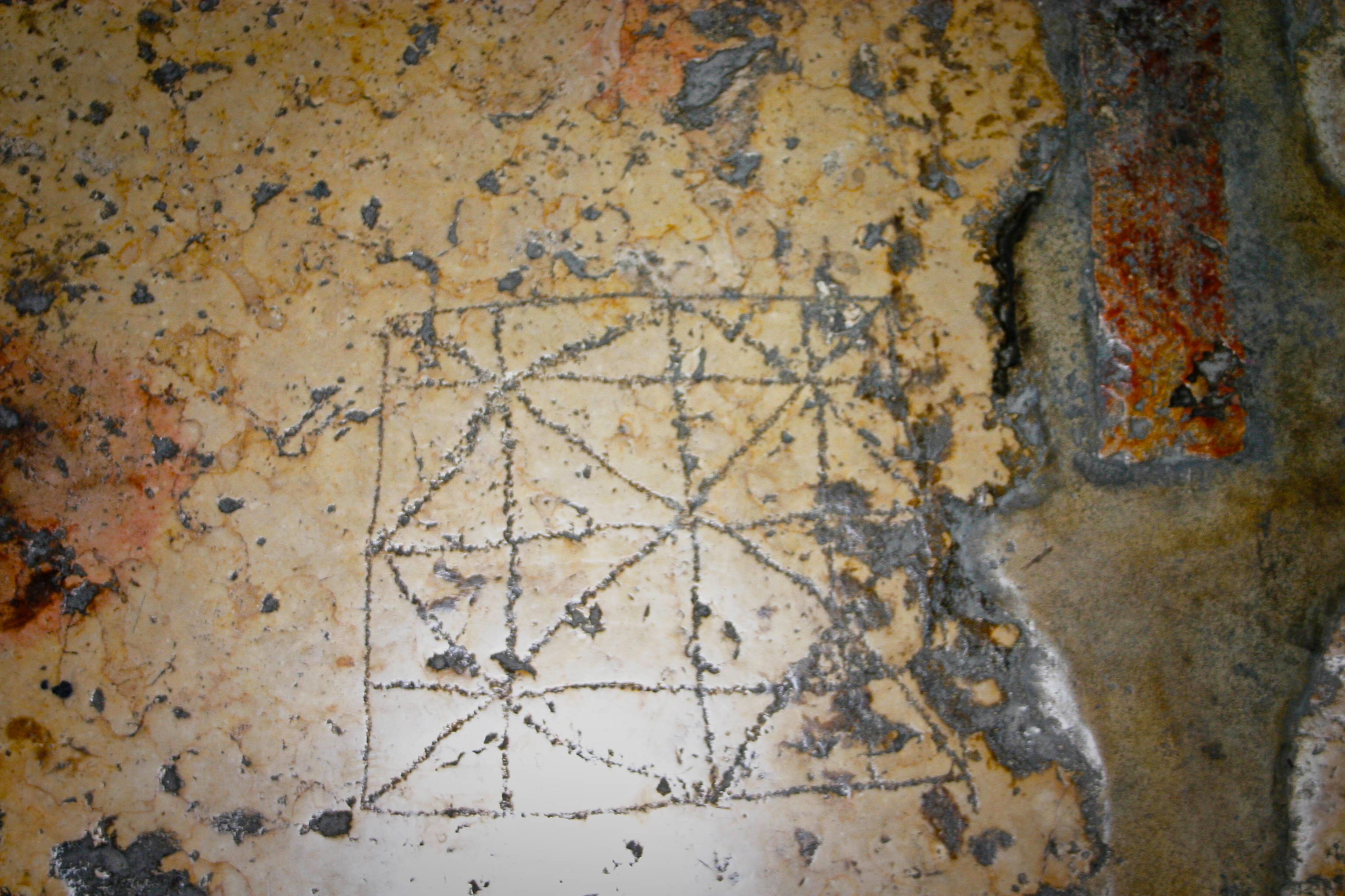
- One of the soldiers’ games carved into Hadrian’s plaza (© Stanislao Lee / Custodia Terrae Sanctae)
-
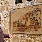
- Mosaic of Jesus on the plaza under the Ecce Homo convent (Seetheholyland.net)
-
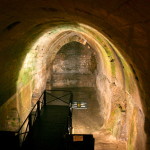
- The cistern known as the Struthion Pool under the Ecce Homo convent (© Marie-Armelle Beaulieu / Custodia Terrae Sanctae)
-
- Ecce Homo Arch in 1864 (James McDonald, Ordnance Survey of Jerusalem)
-
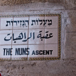
- Sign for Adabat er-Rahbat, or The Nuns Ascent (Fritzmb)
-
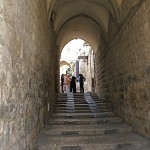
- Adabat er-Rahbat, or The Nuns Ascent (Seetheholyland.net)
-
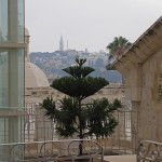
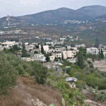
- View towards Mount of Olives from roof of Ecce Homo convent (Seetheholyland.net)
-
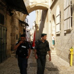
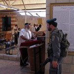
- Today’s soldiers at Ecce Homo Arch (Seetheholyland.net)
-
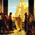
- “Ecce homo!”, depicting Pontius Pilate presenting a scourged Christ to the people, by Antonio Ciseri in 1871 (Galleria d’Arte Moderna, Florence)
-
- Northern arch of Hadrian’s gateway, with remains of central arch rising in wall to the right (Seetheholyland.net)
References
Bar-Am, Aviva: Beyond the Walls: Churches of Jerusalem (Ahva Press, 1998)
Gonen, Rivka: Biblical Holy Places: An illustrated guide (Collier Macmillan, 1987)
Murphy-O’Connor, Jerome: Keys to Jerusalem (Oxford University Press, 2012)
Murphy-O’Connor, Jerome: The Holy Land: An Oxford Archaeological Guide from Earliest Times to 1700 (Oxford University Press, 2005)
Prag, Kay: Jerusalem: Blue Guide (A. & C. Black, 1989)
Walker, Peter: In the Steps of Jesus (Zondervan, 2006)