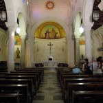
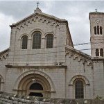
. . . your guide to visiting the holy places  
If you have found See the Holy Land helpful and would like to support our work, please make a secure donation.
The Sites

Israel and Palestine – In Jerusalem

Israel and Palestine – Outside Jerusalem

Jordan

Egypt

Extras

Kathisma

Israel


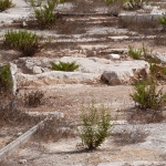
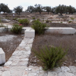
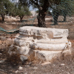
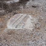
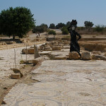
Weeds surround the low rock on which Mary is believed to have rested (Seetheholyland.net)

Weeds surround the low rock on which Mary is believed to have rested (Seetheholyland.net)

Midway between Jerusalem and Bethlehem lie the largely ignored remains of one of the Holy Land’s biggest churches — and probably the first of them dedicated to the Virgin Mary.

The Kathisma church was built around a rock where early Christian tradition says that Mary rested while on her way with Joseph from Nazareth to Bethlehem.

The church was built by a wealthy widow named Ikelia in AD 456 on what was already a major pilgrimage site. It was enlarged in the 6th century, but destroyed around the 11th century.

Its existence was known from Byzantine literature, but the location was a mystery until 1992 when a bulldozer dug into a mosaic floor buried in an olive grove during widening of the Jerusalem-Hebron highway.

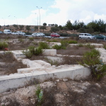
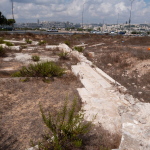
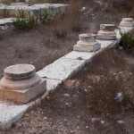
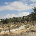
Highway traffic passing ruins of Kathisma church (Seetheholyland.net)

Highway traffic passing ruins of Kathisma church (Seetheholyland.net)

The site is about 6 kilometres from Jerusalem, on the left side of the highway — just before the route 398 turnoff to the Har Homa settlement and Herodium, and 600 metres before the Mar Elias monastery.

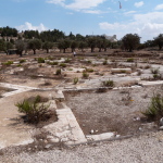
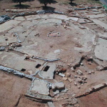
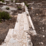
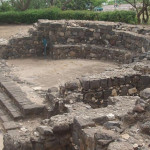
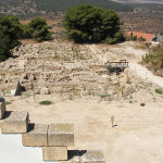
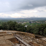
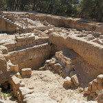
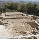
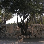
Passing traffic glimpses scattered stonework and weeds between the multi-lane highway and the olive trees, but on the site the octagonal outline of the church is evident. At its centre protrudes the limestone rock on which the pregnant Mary is believed to have rested.


This was more than just a church

Kathisma (the name is Greek for seat) was more than just a church. Archaeologists describe it as a martyrium — a structure intended to bear witness to the Christian faith by commemorating an event in the life of Christ, a martyr or other holy person.

The importance of the structure is shown by its width of 43 metres — only 10 metres less than the octagonal Dome of the Rock, built more than 230 years later and also enclosing a holy rock.

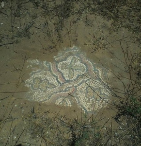
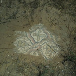
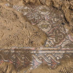
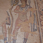
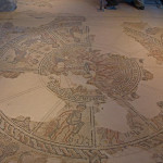
Mosaic floor uncovered at Kathisma (Gabrielw.tour / Wikimedia)

Mosaic floor uncovered at Kathisma (Gabrielw.tour / Wikimedia)

Three concentric walls surrounded the Kathisma rock. The first two formed a walkway leading to a large apse at the eastern end. The third wall encompassed four chapels and adjacent rooms.

Most of the floors were paved with colourful mosaics, in geometric and floral designs. These are well preserved, but covered with sand to protect them.

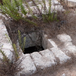
Excavators found a clay waterpipe near the rock. An early tradition says a miraculous spring appeared there to quench Mary’s thirst, and a 6th-century account tells of pilgrims drinking sweet water at the site.


Building may have been shared with Muslims

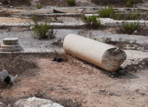
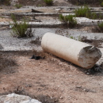
Broken column from Kathisma church (Seetheholyland.net)

Broken column from Kathisma church (Seetheholyland.net)

The Kathisma church escaped destruction during the Persian and Islamic conquests of the 7th century. But evidence of a prayer niche facing Mecca indicates that part or all of the building was used as a mosque in the 8th century.

Bearing in mind the respect shown by the Koran for Mary, experts speculate that this may have been one of a few churches that were shared by Christians and Muslims during the Arab period.

Such harmony did not exist in the middle of the 20th century when the site was in no man’s land during hostilities between Jordan and Israel. The 1949 armistice agreement line (“green line”) runs across the property.

In the 1990s the Greek Orthodox Patriarchate, which owns the site, had plans to develop a major pilgrimage centre but these have not eventuated.


References

Manns, Frédéric: “Stones of Memory”, Holy Land Review, winter 2017
Prag, Kay: Jerusalem: Blue Guide (A. & C. Black, 1989)
Shanks, Hershel: “Where Mary Rested — Rediscovering the Kathisma”, Biblical Archaeological Review, November/December, 2006
Vamosh, Miriam Feinberg: “The Kathisma: The most important ancient church you never heard of”, Haaretz, February 24, 2014


External links

Kathisma — Place of Rest on the Way to Bethlehem (Travelujah)
Kathisma (BibleWalks)
The Church of the Seat of Mary (Israel Ministry of Foreign Affairs)

Tiberias

Israel

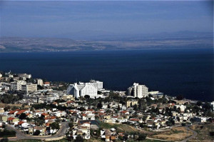
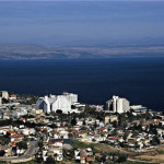
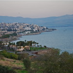
The thriving resort of Tiberias, with its balmy climate, lakeside hotels and fish restaurants, is a popular base for Christian pilgrims exploring the Galilee that Jesus knew.

Tiberias

Modern Tiberias (© Israel Ministry of Tourism)

Its location on the western shore of the Sea of Galilee (also called the Sea of Tiberias in John’s Gospel) is within easy reach of the Mount of Beatitudes, Capernaum, Tabgha, Bethsaida, Chorazin, Magdala, Kursi, Cana, Mount Tabor, Nain and Nazareth.

Tiberias was a new city when Jesus began his public ministry. Herod Antipas, a son of Herod the Great, founded it around AD 20 to replace Sepphoris as his capital.

Antipas — who would later behead Jesus’ cousin John the Baptist — chose a site just south of the present resort, taking advantage of 17 hot springs renowned since ancient times for their healing qualities. He named his new city after his patron, the emperor Tiberius Caesar.

Tiberias

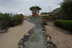
Hot springs at Tiberias (David Q. Hall)

Because the site lay over ancient burial grounds, observant Jews refused to incur ritual impurity by living there. Antipas had to resort to compulsion and financial inducements to populate his city.

Though Jesus spent much of his ministry on and around the Sea of Tiberias, its inappropriate siting may explain why there is no record that he ever visited Tiberias.


Powerhouse of Jewish scholarship

Ritual purification of the city was carried out in the middle of the second century AD. The timing was opportune. The Second Jewish Revolt had failed, and the Romans had responded by banning Jews from Jerusalem.

Jews flocked to Tiberias, which became the major centre of Jewish culture and learning, with 13 synagogues. Even the Sanhedrin (the supreme court) moved from Sepphoris. “Preachers, poets, scholars and rabbis abounded,” wrote historian G. S. P. Freeman-Grenville.

Over the following centuries, it was this powerhouse of Jewish scholarship that compiled almost all of the Jerusalem Talmud — one of the two central texts of Jewish religious teaching and commentary that had previously been transmitted orally — and the fixed Hebrew text of the Jewish Bible.

Tiberias

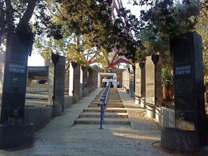
Tomb of Maimonides (Bukvoed)

A Christian community was established in the 4th century, when Tiberias became a major destination for pilgrims visiting the Christian sites of the Galilee region.

In 1033 an earthquake destroyed Tiberias. The Crusaders rebuilt it about two kilometres further north, where the present city stands.


Rabbi’s body was carried from Egypt

Tiberias

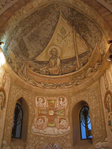
St Peter in his boat, at St Peter’s Church, Tiberias (© Custodia Terrae Sanctae)

Thanks to successive conquests, modern Tiberias has fewer monuments or ancient ruins than other localities in the Holy Land.

Historic sites include the graves of several distinguished rabbis. These include the celebrated philosopher Maimonides, leader of the Jewish community in Cairo in the 12th century. In accordance with his will, his body was carried overland on the route believed to have been taken by Moses and the Israelites to the Promised Land, for burial in Tiberias (his grave is on Ben Zakkai Street).

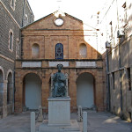
One of the few remaining Crusader buildings is the Church of St Peter, hidden down an alley from the lakeside promenade. Erected around 1100, this Catholic church was a mosque, a caravanserai and a stable for animals before being rebuilt in 1870 by the Franciscans.

Remains of an older church, from the 6th century, have been discovered in a commanding position on Mount Berenice, west of the city. It is called the Anchor Church, because a huge stone with a hole in its centre was found under the base of the altar.


Coins found with likeness of Jesus

South of the modern city, where steam from hot springs rises above the ground, are a national park and an archaeological park.

The highlight of the national park is a 4th-century synagogue with a spectacular mosaic floor. It was discovered in 1921 during the first major archaeological dig led by Zionist Jews in Israel.

Tiberias

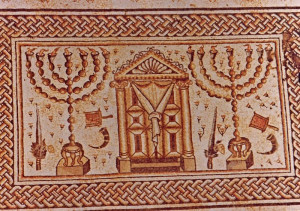
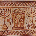
Ark of the Torah flanked by menorah, in synagogue mosaic at Tiberias (© Israel Ministry of Tourism)

In a curious mix of Jewish and pagan symbols, the Ark of the Torah is flanked by a pair of menorah, but immediately below is a Zodiac circle revolving around the figure of the pagan sun god Helios riding his celestial chariot.

The archaeological park contains the remains of the old city of Tiberias.

Excavations have uncovered part of the cardo (main street), a bathhouse, an unidentified colonnaded building, a reservoir, a tower and the south gate complex.

Tiberias

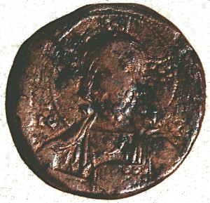
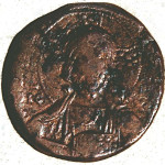
Bronze coin with likeness of Jesus discovered at Tiberias

A treasure trove of bronze coins was discovered in 1998, hidden in pottery jars under the floor of a building. They included 58 bearing the likeness of Jesus, with Greek inscriptions such as “Jesus the Messiah, the King of Kings”, minted in Constantinople in the 11th century.


Hammat Tiberias National Park

Tel.: 972-4-6725287

Open: Apr-Sep 8am-5pm; Oct-Mar 8am-4pm (last entry one hour before closing time)


St Peter’s Church

Tel.: 972-4-6721059

Open: 8am-12.30pm, 2.30-5.30pm


References

Bourbon, Fabio, and Lavagno, Enrico: The Holy Land Archaeological Guide to Israel, Sinai and Jordan (White Star, 2009)
Charlesworth, James H.: The Millennium Guide for Pilgrims to the Holy Land (BIBAL Press, 2000)
Dyer, Charles H., and Hatteberg, Gregory A.: The New Christian Traveler’s Guide to the Holy Land (Moody, 2006)
Rainey, Anson F., and Notley, R. Steven: The Sacred Bridge: Carta’s Atlas of the Biblical World (Carta, 2006)
Freeman-Grenville, G. S. P.: The Holy Land: A Pilgrim’s Guide to Israel, Jordan and the Sinai (Continuum Publishing, 1996)
Gonen, Rivka: Biblical Holy Places: An illustrated guide (Collier Macmillan, 1987)
Heinsch, James: “Tiberias Church of St Peter”, Holy Land, Autumn 1999.
Kochav, Sarah: Israel: A Journey Through the Art and History of the Holy Land (Steimatzky, 2008)
Murphy-O’Connor, Jerome: The Holy Land: An Oxford Archaeological Guide from Earliest Times to 1700 (Oxford University Press, 2005)
Prag, Kay: Israel & the Palestinian Territories: Blue Guide (A. & C. Black, 2002)
Shahin, Mariam, and Azar, George: Palestine: A guide (Chastleton Travel, 2005)


External links

Hammat Tiberias (BibleWalks)
Tiberias (Custodia Terrae Sanctae)
Tiberias — The Anchor Church (Israel Ministry of Foreign Affairs)

Sepphoris

Israel


Sepphoris

Sepphoris with Nazareth on hill in distance (Steve Peterson)

Sepphoris, a ruined city 6.5 kilometres northwest of Nazareth, was the capital of Galilee during the time of Jesus. Though it is not mentioned in the New Testament, it is of interest to Christian pilgrims for two main reasons:

•  The rebuilding of the city by Galilee’s ruler, Herod Antipas, may have attracted the building tradesman Joseph and his wife Mary to settle in Nazareth when they returned with Jesus from Egypt.

This major building site, 50 minutes’ walk from Nazareth, would have offered Joseph many years of employment. It may also be where Jesus gained insights into the building trade — such as the need to build with foundations on rock rather than on sand (Luke 6:48-49).

•  According to tradition, the original home of Mary’s parents, Joachim and Anne (or Anna), was at Sepphoris. During the 12th century the Crusaders built a huge Church of St Anna, possibly on the site of their home.

Sepphoris rose to prominence during the century before Christ because it overlooked two major highways. A mainly Jewish city, it was given its Hebrew name, Zippori, because it sits on a hilltop like a bird (zippor).

According to the historian Josephus, Herod Antipas made it “the ornament of Galilee”, a term also implying the military connotation of an impregnable city.

Sepphoris

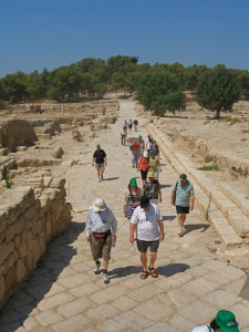
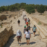
Pilgrims on Decumanus street at Sepphoris (Seetheholyland.net)

After the destruction of Jerusalem in AD 70, Sepphoris became a centre of Jewish learning and seat of the Sanhedrin supreme court. The Mishnah, the first authoritative collection of Jewish oral law, was compiled here.

A Christian community was present by the 4th century. By the 6th century it was sufficiently large to have its own bishop.

It was from Sepphoris that the Crusaders rode out in 1187 for their defeat by the Muslim sultan Saladin at the Horns of Hattin, overlooking the Sea of Galilee — a defeat that brought about the end of the Crusader Kingdom of Jerusalem.


Many changes of name

Sepphoris has worn many names during its history.

It was Zippori (or Tzippori) when Herod the Great captured it during a snowstorm in 37 BC. After Herod’s death in 4 BC the Roman army put down a rebellion of Jewish rebels by destroying the city and selling many of its people into slavery.

When Herod’s son Herod Antipas rebuilt the city, he renamed it Autocratoris.

Because the inhabitants chose not to join the First Jewish Revolt against Rome in AD 66-73, the city was spared the destruction suffered by other Jewish centres, including Jerusalem. Evidence of the city’s pacifist stance comes from coins inscribed “City of Peace” minted there during the revolt.

Before the Second Jewish Revolt in 132-135, the Romans changed the name to Diocaesarea. A massive earthquake in 363 devastated the city and it was only partly rebuilt.

The Muslim conquest in the 7th century saw another name change, to Saffuriya. Except for a period as La Sephorie under the Crusaders, this name remained for what became an Arab village until the population of about 4000 fled attacks by Israeli forces during the 1948 Arab-Israeli War.


Three apses of church still stand

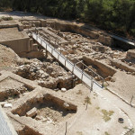
Excavations at Sepphoris have uncovered streets, houses, public buildings, bathhouses, a market, two churches, a synagogue, a Roman theatre, aqueducts, a huge elongated water reservoir (260 metres long) and more than 40 mosaic floors.

Sepphoris

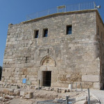
Crusader fortress overlooking Sepphoris (© Ori~ / Wikimedia)

A Crusader fortress, built on the remains of an earlier structure, dominates the upper part of the site and provides a panoramic view from its roof. It now houses a museum.

To the west of the summit, on the northwestern perimeter of Sepphoris National Park, are the remains of the Crusader Church of St Anna. Inside a walled enclosure, the three apses are still standing, now incorporated into the western wall of a modern Monastery of the Sisters of St Anne (where the key to the enclosure is available).

Northeast of the fortress is the Roman theatre, its tiers of 4500 seats carved into the northern slope of the hill.

Sepphoris

Remains of Church of St Anna at Sepphoris (© Custodia Terrae Sanctae)

Biblical scholars have conjured with the possibility that Jesus might have known this theatre and even taken from it the word “hypocrite” — Greek for one who is play-acting — which he frequently used (in Matthew 6, for example). But archaeologists are uncertain whether the theatre was in use when Jesus lived in Nazareth.

On the northern edge of the park are remains of a 6th-century synagogue with a mosaic floor depicting biblical scenes, Temple rituals and a zodiac wheel.


Mosaic portrait dubbed “Mona Lisa”

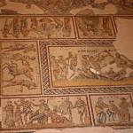
Just south of the Roman theatre stood a palatial mansion built in the 3rd century AD. Known as the Dionysus House, it was destroyed by the earthquake in 363, but the remarkable mosaic carpet in its stately dining room survived well-preserved under the debris.

The 15 centre panels depict scenes from the life of Dionysus, the Greek god of wine and revelry, bordered by medallions of acanthus leaves with hunting scenes.

Sepphoris

“Mona Lisa of the Galilee” in Roman mansion at Sepphoris (Seetheholyland.net)

Each scene is labelled with a Greek word — a panel displaying a completely inebriated Hercules is labelled MEQH, meaning drunkenness.

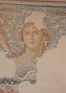
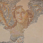
But the most remarkable feature of the mosaic floor is an elegant portrait of an unknown woman at the centre of one end. The engaging tilt of her head and enigmatic expression have earned her the nickname “Mona Lisa of the Galilee”.

The unknown artist of this portrait used tiny stones, in a wide range of natural colours, and with an exquisite attention to detail and shading.


Elegant mosaics illustrate life on River Nile

An impressive network of well-planned streets has been exposed in the lower city. Two major intersecting streets, the north-south Cardo and the east-west Decumanus, had covered footpaths and shops on both sides.

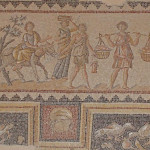
East of the Cardo, a large building called the Nile House had some 20 rooms decorated with multi-coloured mosaic floors. The most elegant depict scenes associated with the River Nile in Egypt.

Sepphoris

Nilometer and river scenes in Sepphoris mosaic (Seetheholyland.net)

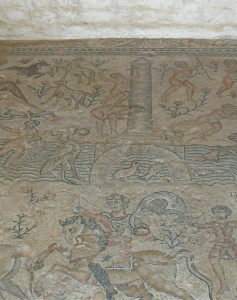
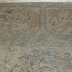
In the most impressive mosaic, the river flows through the picture and wildlife such as fish and birds are seen along its banks. On the left a reclining female figure with a basket of harvest fruits personifies Egypt; on the right a male figure represents the Nile.

In the centre a man standing on a woman’s back records 17 cubits (about 8 metres) on a nilometer — a pillar with a scale to measure the height of the Nile during its seasonal flood.

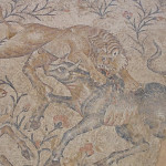
The lower portion shows hunting scenes: A fierce lion pouncing on the back of a bull, a panther leaping on a gazelle, and a boar being attacked by a bear.

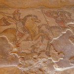
Other mosaics in the building include a depiction of Amazon warriors hunting from horseback.


Administered by: Israel National Parks Authority

Tel.: 04-656-8272

Open: 8am-5pm (4pm Oct-Mar) with last entry one hour earlier; closes at 3pm on Fridays and eves of Jewish holidays.


References

Bourbon, Fabio, and Lavagno, Enrico: The Holy Land Archaeological Guide to Israel, Sinai and Jordan (White Star, 2009)
Chancey, Mark, and Meyers, Eric M.: “Spotlight on Sepphoris: How Jewish was Sepphoris in Jesus’ Time?”, Biblical Archaeology Review, July/August 2000
Charlesworth, James H.: The Millennium Guide for Pilgrims to the Holy Land (BIBAL Press, 2000)
Charlesworth, James H.: Jesus and Archaeology (Wm. B. Eerdmans, 2006)
Freeman-Grenville, G. S. P.: The Holy Land: A Pilgrim’s Guide to Israel, Jordan and the Sinai (Continuum Publishing, 1996)
Kochav, Sarah: Israel: A Journey Through the Art and History of the Holy Land (Steimatzky, 2008)
Losch, Richard R.: The Uttermost Part of the Earth: A guide to places in the Bible (Wm. B. Eerdmans, 2005)
Murphy-O’Connor, Jerome: The Holy Land: An Oxford Archaeological Guide from Earliest Times to 1700 (Oxford University Press, 2005)
Shahin, Mariam, and Azar, George: Palestine: A guide (Chastleton Travel, 2005)
Walker, Peter: In the Steps of Jesus (Zondervan, 2006)
Weiss, Ze’ev. “The Sepphoris Synagogue Mosaic”, Biblical Archaeology Review, September/October 2000
Weiss, Ze’ev, and Tsuk, Tsvika: Zippori National Park (Israel Nature and Parks Authority leaflet)

External links

Sepphoris (BibleWalks)
Sepphoris (BiblePlaces)
Sepphoris (The Bible and Interpretation)
The USF Excavations at Sepphoris (CenturyOne Foundation)
Zippori — “The Ornament of All Galilee” (Israel Ministry of Foreign Affairs)

Nazareth Village

Israel


Nazareth Village

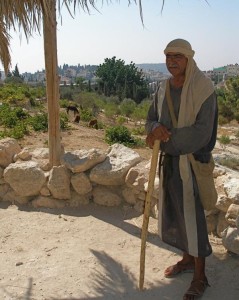
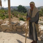
Watchman on his tower at Nazareth Village (Seetheholyland.net)

Small-town life in the time of Jesus has been authentically recreated at Nazareth Village, just 500 metres south-west of the landmark Church of the Annunciation.

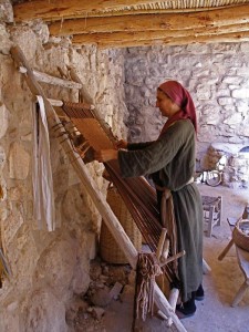
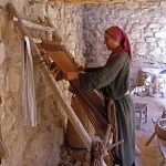
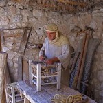
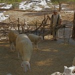
On hillside farm terraces growing olives, figs and pomegranates, visitors can encounter a shepherd tending his flock, a carpenter using his tools and a weaver demonstrating her craft.

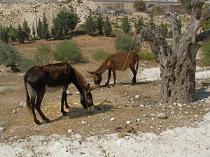
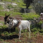
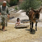
As the seasons pass, a farmer breaks open the ground with a plough pulled by donkeys, crops are planted and pruned, olives are harvested and pressed, grapes are picked and crushed by foot, and wheat is cut and threshed.

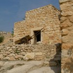
There is a watchtower, a quarry, an irrigation system and a village synagogue that accurately replicates a first-century Jewish house of worship.

In this parable-rich environment, in-character villagers in authentic costumes demonstrate farming practices and talk about their daily life and work as they relate to the Gospels.


A working farm in Jesus’ time

Nazareth Village opened in 2000 as the fulfillment of a long-held vision of Dr Nakhle Bishara, medical director of the adjacent Nazareth Hospital and a local historian.

Nazareth Village

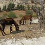
Donkeys grazing at Nazareth Village (Seetheholyland.net)

It occupies a 6-hectare site that was previously vacant hospital land. Archaeologists have confirmed the site would have been a working terrace farm in Jesus’ time, probably the property of a single extended family.

Scholarly research led by experts from the Jerusalem-based University of the Holy Land underpinned the project. Village buildings were erected in stone, using first-century construction methods.

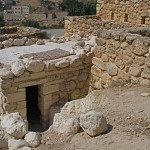
An early archaeological discovery was an ancient man-made basin, cut into the bedrock, that was used for making wine. This level area where grapes were treaded had a channel leading to a pit where the runoff juice was collected.

Pottery from as far back as the Early Bronze Age — more than 2000 years before Christ — was found on the site.


Meals of first-century foods

Nazareth Village

Weaving on a loom at Nazareth Village (Seetheholyland.net)

Nazareth Village is a non-profit Christian enterprise. It is backed by an interdenominational collection of locals and international identities such as former United States president Jimmy Carter and singer Pat Boone, and volunteers from around the world join its staff for varying periods of time.

Tours of the village take about an hour and a half, beginning with displays giving the historical context of Jewish life under Roman occupation in the 1st century.

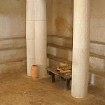
Special-event meals can be arranged for groups, in which typical first-century foods are served with fresh herbs and savoury flat bread in a stone dining area with arched spans.

A gift shop offers a range of products linked to the life of Jesus, including books, art, costumes, frankincense, nard and mustard seeds.

The authentic character of Nazareth Village has often attracted television and movie companies to use it as a setting for period productions.


Other sites in Nazareth:

Nazareth

Church of the Annunciation

Church of St Joseph

Administered by: Nazareth Village Board

Tel.: 972 4 6456042; fax 972 4 6559295

Open: 9am-5pm (last tour begins 3.30pm); closed Sunday, New Year’s Day, Good Friday, Easter Monday, Independence Day, Christmas Day, December 26.


References

Kauffmann, Joel: The Nazareth Jesus Knew (Nazareth Village, 2005)
Pfann, Stephen; Voss, Ross; and Rapuano, Yehudah: “Surveys and Excavations at the Nazareth Village Farm (1997–2002): Final Report”, Bulletin of the Anglo-Israel Archaeological Society, volume 25 (2007)
Smith, David: “Where it happened”, The Jerusalem Post Christian Edition, December 2007
Walker, Peter: In the Steps of Jesus (Zondervan, 2006)


External links

Nazareth Village

Nazareth

Israel

Church of the Annunciation

Church of St Joseph

Mary’s Well and Church of St Gabriel

First-century houses

Nazareth Village

Church of the Synagogue

Church of the Nutrition

Mount Precipice

Franciscan Museum

Church of Jesus the Adolescent


Nazareth in Galilee is celebrated by Christians as the town where the Virgin Mary, aged around 14 years, agreed to become pregnant with the Son of God.
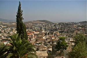
Nazareth

Modern Nazareth (© Israel Ministry of Tourism)

It also became the home town of Jesus, Mary and her husband Joseph after the Holy Family returned from fleeing to Egypt to escape Herod the Great’s soldiers.

Nazareth is not mentioned in the Old Testament and has the reputation of being an insignificant backwater — epitomised by Nathanael’s retort when told that Jesus of Nazareth was the Messiah: “Can anything good come out of Nazareth?” (John 1:46).

But being hidden from the public eye, nestled in a hollow among the hills of Galilee, it provided an ideal setting for the years of preparation Jesus needed as he “increased in wisdom and in years, and in divine and human favour” (Luke 2:52).

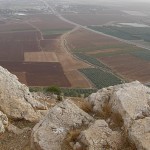
It was also a place from which a young boy could watch the world go by: South of the village, a vantage point overlooked the Plain of Jezreel, where traders and travellers passed along a great highway between Babylon and Cairo.


Church of the Annunciation
Nazareth

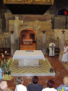
Grotto of the Annunciation (Seetheholyland.net)

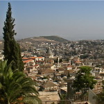
Modern-day Nazareth is dominated by the towering cupola of the Church of the Annunciation. It is an Arab city, mainly Muslim, with an adjoining Jewish upper city of Nof HaGalil (formerly Nazareth Ilit), but a profusion of churches, monasteries and other religious institutions make it a major centre of Christian pilgrimage.

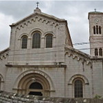
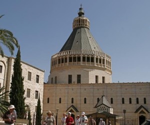
The massive two-storey Church of the Annunciation, in strikingly modern architectural style and colourfully decorated, is the largest Christian church in the Middle East.

Its cupola, surmounted by a lantern symbolising the Light of the World, stands directly over a cave in the crypt that is traditionally held to be the home of the Virgin Mary. Here, it is believed, the archangel Gabriel told Mary she would become the mother of the Son of God.

The grotto is flanked by remnants of earlier churches on the site. Its entrance is sometimes closed by a protective grille.

The entrance to the lower church is from the west, where above the triple doorway the façade of cream limestone carries a quotation in Latin: “The Word was made flesh, and dwelt among us” (John 1:14).

A spiral stairway at the main entrance leads to the upper church. This is the parish church for the Catholic community of Nazareth (which is why the inscriptions on the ceramic Stations of the Cross are in Arabic). The main entrance for the upper church is on the northern side.

Over a door on the southern side is a statue of Mary aged 14, the age she is believed to have been at the time of the Annunciation, welcoming all who come to visit her home.


Church of St Joseph

Next to the Church of the Annunciation, on the northern side, is the Church of St Joseph (also known as the Church of the Nutrition and Joseph’s Workshop).

This is a solid and unpretentious building, very much in the shadow of the imposing Annunciation basilica — just as St Joseph himself lived in the shadow of Jesus and Mary.

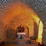
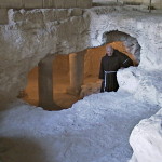
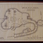
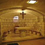
Stairs lead down to a crypt, where a 2-metre square basin cut into the rock, its floor decorated in a black-and-white mosaic, is believed to be a pre-Constantinian baptismal site.

Further steps and a narrow passage lead to an underground chamber. A pious tradition from the 17th century, with no foundation, holds that this chamber was Joseph’s carpentry workshop.

Even if the site was the home of the Holy Family, it is unlikely to have had a carpentry workshop in the modern sense. The Gospels use the Greek word tekton, meaning builder or artisan, to describe Joseph. He most likely worked with stone more than with wood, since stone was the common building material.

The apse of the church has three noteworthy paintings: The Holy Family, The Dream of Joseph, and The Death of Joseph in the Arms of Jesus and Mary.


Mary’s Well
Nazareth

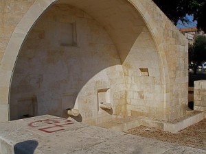
Mary’s Well, Nazareth (Seetheholyland.net)

Some 400 metres north of the Church of the Annunciation, just off the main street, is Mary’s Well. Fed by the main freshwater spring in the little village, it would have been visited daily by Mary, often accompanied by her young son.

According to the Greek Orthodox, whose Church of St Gabriel is adjacent, this is the true site of the Annunciation. But both traditions can be accommodated by an account in the early Protoevangelium of James.

This apocryphal document says the archangel Gabriel first approached Mary as she went to draw water at the well. Frightened by the stranger’s approach, the young girl ran back to her home. There the archangel appeared again and this time delivered his message.

The present water-trough structure is a reconstruction carried out in 2000. Water is piped from the spring, about 200 metres to the north.

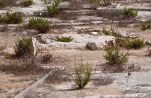
Water from the spring can be seen in St Gabriel’s Church, in a well-like structure in the crypt. The stonework dates from the time of the Crusaders, who also built a church on this site. St Gabriel’s, surrounded by a high wall, contains many interesting icons and frescoes.


First-century houses

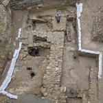
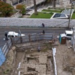
In December 2009 the Israel Antiquities Authority announced the discovery of a house from the time of Christ in the centre of Nazareth. It said this was “the very first” residential building found from the old Jewish village.

Small and modest, the house consisted of two rooms and a courtyard with a cistern to collect rainwater.

The remains of the house were found during an excavation prior to construction of the now-closed Mary of Nazareth International Center, next to the Church of the Annunciation. The remains were conserved and displayed in that building.

In 2015 the remains of a first-century domestic building within the Sisters of Nazareth Convent, across the street from the Church of the Annunciation, was suggested as the house where Byzantine church builders believed Jesus spent his childhood. Byzantine and Crusader churches had been built on the site.

This house has been given the name of the Church of the Nutrition, meaning “the church of the upbringing of Christ”.


Additional sites in Nazareth

Nazareth has several other sites of interest to pilgrims:

Nazareth Village: Life in the time of Jesus has been authentically recreated on the site of a 1st-century working terrace farm, just 500 metres south-west of the Church of the Annunciation.

Visitors can see and hear the animals, smell and taste the food, see donkeys pull a plough and hear in-character villagers talk about daily life and their work at the wine and olive presses, on the threshing floor and in the weaving room.

Besides watchtowers, a spring-fed irrigation system and an ancient quarry, the village has an accurate replica of a 1st-century synagogue.

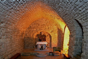
Synagogue Church: The dome and bell towers of this Melkite Greek Catholic church rise over the old market of Nazareth, up a street almost due east of St Joseph’s Church.
Nazareth

Synagogue Church, Nazareth (Seetheholyland.net)

The church incorporates a Crusader building believed to be on the site of the synagogue in which Jesus preached. This simple stone room with a plain altar evokes the Gospel account (Luke 4:16-30) in which Jesus read the Messianic passage in Isaiah 61 (“The spirit of the Lord is upon me”) and proclaimed that he was the fulfilment of this promise.

The initial response was favourable, but when Jesus indicated that the proclamation of the Good News was to include the gentiles, his hearers were enraged and tried to throw up off a high cliff.

Church of the Nutrition: Only around 100 metres from the Church of the Annunciation and 200 metres from the Church of St Joseph is a lesser-known site that may include the remains of Jesus’ childhood home.

Archaeological research in 2006-10 indicated that an underground complex beneath the convent of the Sisters of Nazareth in 6166 Street may be the location of the long-lost Byzantine-era Church of the Nutrition, believed to have been built over the house of Mary and Joseph, and where Jesus was nurtured.

Visits are by appointment (tel.: 972-4-6554304).

Mount Precipice: South of Nazareth, on Mt Kedumim, is the cliff on which it is supposed the attempt was made to throw Jesus to his death. A road leads to the site and the view over the Jezreel Valley and Mount Tabor is spectacular.

On the mountain is a ruined church called Our Lady of the Fright Chapel. It commemorates the tradition that Mary, the mother of Jesus, fainted with fear as the crowd led her son to the cliff. But the Gospel says Jesus “passed through the midst of them and went on his way” (Luke 4:30).

Franciscan Museum: A courtyard on the northern side of the Church of the Annunciation provides access to a museum, on a lower level, displaying artefacts dating back to the 1st century. Of particular interest are five superbly carved capitals, discovered buried in a cave in 1908. Carved in France, they were to have crowned columns at the entrance of the Crusader church. They arrived after the Crusader kingdom had been defeated, so they were hidden.

Church of Jesus the Adolescent: This attractive French Gothic-style church, atop the western Nabi Sain ridge, offers a fine view over Nazareth’s rooftops and the Galilean hills. Above the altar is an impressive marble statue of Jesus as a boy of about 16.


In Scripture:

The Annunciation: Luke 1:26-38

The Holy Family settles in Nazareth: Matthew 2:23; Luke 2:39-40

Jesus preaches in the synagogue: Luke 4:16-30; Matthew 13:53-58; Mark 6:1-6;

“Can anything good come out of Nazareth?”: John 1:45-46


Open:

Church of the Annunciation: 8am-6pm

Church of St Joseph: 8am-6pm

St Gabriel’s Church: 8am-noon. 1-5pm; telephone first on Sunday

Synagogue Church: 8am-5pm (4pm Oct-Mar); closed Sunday

Nazareth Village: 9am-5pm (last tour begins 3.30pm); closed Sunday


References

Brownrigg, Ronald: Come, See the Place: A Pilgrim Guide to the Holy Land (Hodder and Stoughton, 1985)
Charlesworth, James H.: The Millennium Guide for Pilgrims to the Holy Land (BIBAL Press, 2000)
Dark, Ken: “Has Jesus’ Nazareth House Been Found?”, Biblical Archaeology Review, March-April 2015
Doyle, Stephen: The Pilgrim’s New Guide to the Holy Land (Liturgical Press, 1990)
Freeman-Grenville, G. S. P.: The Holy Land: A Pilgrim’s Guide to Israel, Jordan and the Sinai (Continuum Publishing, 1996)
Gonen, Rivka: Biblical Holy Places: An illustrated guide (Collier Macmillan, 1987)
Israel Antiquities Authority: “A Residential Building from the Time of Jesus was Exposed in the Heart of Nazareth”, media release, December 23, 2009
Joseph, Frederick: “Basilica of the Annunciation in Nazareth”, Holy Land, spring 2005
Kilgallen, John J.: A New Testament Guide to the Holy Land (Loyola Press, 1998)
Murphy-O’Connor, Jerome: The Holy Land: An Oxford Archaeological Guide from Earliest Times to 1700 (Oxford University Press, 2005)
Smith, David: “Where it happened”, The Jerusalem Post Christian Edition, December 2007
Walker, Peter: In the Steps of Jesus (Zondervan, 2006)
Wareham, Norman, and Gill, Jill: Every Pilgrim’s Guide to the Holy Land (Canterbury Press, 1996)

External links

Nazareth (Custodia Terrae Sanctae)
Nazareth (Wikipedia)
Nazareth (Catholic Encyclopedia)
Nazareth (Nazareth Cultural & Tourism Association)
St Gabriel Church (BibleWalks)
Mount Precipice (BibleWalks)

Mount Tabor

Israel

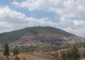
Mount Tabor, rising dome-like from the Plain of Jezreel, is the mountain where Christian tradition places the Transfiguration of Jesus.

Mount Tabor with Franciscan monastery on top (Seetheholyland.net)

Mount Tabor with Franciscan monastery on top (Seetheholyland.net)

Scholars disagree on whether Mount Tabor was the scene of that event (described in Matthew 17:1-9; Mark 9: 2-8 and Luke 9:28-36). However, it has throughout history been a place of mystique and atmosphere, where humanity has sought contact with the divine.

Its unique contours — variously described as “breast-shaped”, “hump-backed” and “resembling an upside down tea cup” — captured the imagination of ancient peoples who attached to it supernatural qualities.

Mount Tabor stands some 420 metres above the plain in lower Galilee, 7km east of Nazareth. It held a strategic position at the junction of trade routes. Many battles have been fought at its foot.

In the Old Testament, Mount Tabor is described as a sacred mountain and a place for worship. It is not mentioned by name in the New Testament.


Location of Transfiguration is questioned

Mount Tabor

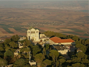
Church buildings on Mount Tabor (Wikimedia)

The Gospel accounts of the Transfiguration — a momentous event in which Peter, James and John were introduced to the divine incarnation of Christ, the God-Man — do not specify the place. They simply say it was a “high mountain” in Galilee.

Christian tradition in the early centuries named the mountain as Tabor. This location is cited in early apocryphal writings and was accepted by the Syriac and Byzantine churches.

Many biblical scholars now question this tradition. Mount Tabor’s location does not fit well into events before and after the Transfiguration. At the time, a Hasmonean fortress stood on the summit.

And would Tabor be considered a “high mountain”, especially compared to other mountains in the vicinity? (It’s actually more than 200 metres lower than Jerusalem.)

These scholars see the much higher Mount Hermon as a more likely location.

Nevertheless, a succession of churches and a monastery were built on Mount Tabor from the fourth century.


Hairpin bends take taxis to the top

Mount Tabor

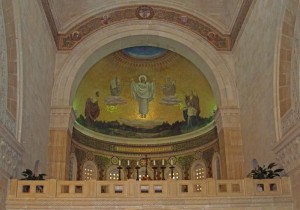
Mosaic of Transfiguration in apse of Church of the Transfiguration (Seetheholyland.net)

After the Crusaders were defeated in the 12th century and the area was taken over by the Turks, the Mamluk sultan Baybars destroyed all the religious buildings on Mount Tabor in 1263. Tabor remained deserted for nearly 400 years until the Franciscans negotiated permission to settle there.

Early pilgrims used to climb 4300 steps cut into the rocky slope to reach the summit. These days taxis negotiate a succession of hairpin bends before they suddenly reach the summit.

The present Catholic and Greek Orthodox buildings (separated by a wall) were constructed in the late 19th and early 20th centuries.

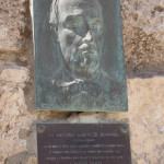
The prominent Catholic Church of the Transfiguration, designed by the Italian architect Antonio Barluzzi, stands among ruins of a Benedictine monastery. A bas-relief of the architect, who designed many of the Holy Land’s churches, is set into a wall on the right of the entrance.

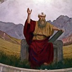
Its entrance is flanked by chapels dedicated to Moses and Elijah, who were seen with Jesus during his Transfiguration. The event itself is depicted above the main altar in the central apse.

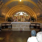
In the crypt under the church are the altar and fragments of walls of a Byzantine church. There is a tradition that the rock floor of the crypt is where Jesus stood during the Transfiguration.

The Greek Orthodox church, often not open to visitors, honours Elijah. It too is built on the ruins of Byzantine and Crusader churches.


‘Breadbasket’ scene of battles

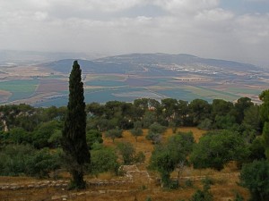
Mount Tabor’s height affords uninterrupted panoramas. From the balcony of the Franciscan hospice, the view is of the plain of Jezreel, bounded by the Carmel range and the mountains of Samaria.

The fertile plain is called “the breadbasket of Israel”, a reminder that one of the meanings of Jezreel is “God sows”.

Mount Tabor

Jezreel Valley from Mount Tabor (Seetheholyland.net)

But this plain has often resounded to the clash of battle.

On the slopes of Mount Tabor, in the time of the Judges, the prophetess Deborah and her general Barak marshalled their warriors before sweeping down to rout the 900 chariots of Sisera and his Canaanites (Judges 4:4-16).

Armies of all the great generals who campaigned in the Middle East have tramped across the plain, from the pharaoh Thutmose III to General Edmund Allenby, and including Alexander the Great and Napoleon.

And in the Book of Revelation, it is named as the scene of the battle of Armageddon (also called Harmagedon or Har-Megiddo), in which good will triumph over evil.


In Scripture:

Deborah and Barak’s triumph: Judges 4:4-14

The Transfiguration: Matthew 17:1-9; Mark 9: 2-8 and Luke 9:28-36


Administered by: Franciscan Custody of the Holy Land

Tel.: 972-4-6620720

Open: 8am-noon, 2-5pm


References

Brownrigg, Ronald: Come, See the Place: A Pilgrim Guide to the Holy Land (Hodder and Stoughton, 1985)
Charlesworth, James H.: The Millennium Guide for Pilgrims to the Holy Land (BIBAL Press, 2000)
Freeman-Grenville, G. S. P.: The Holy Land: A Pilgrim’s Guide to Israel, Jordan and the Sinai (Continuum Publishing, 1996)
Gonen, Rivka: Biblical Holy Places: An illustrated guide (Collier Macmillan, 1987)
Murphy-O’Connor, Jerome: The Holy Land: An Oxford Archaeological Guide from Earliest Times to 1700 (Oxford University Press, 2005)
Pixner, Bargil: With Jesus Through Galilee According to the Fifth Gospel (Corazin Publishing, 1992)
Wareham, Norman, and Gill, Jill: Every Pilgrim’s Guide to the Holy Land (Canterbury Press, 1996)


External links

Mount Tabor (Custodia Terrae Sanctae)
Mount Tabor (BiblePlaces)
Mount Tabor Hike (Israel by Foot)

Church of the Annunciation

Israel

Church of the Annunciation

Church of the Annunciation (© Tom Callinan / Seetheholyland.net)

The towering cupola of the Church of the Annunciation in Nazareth stands over the cave that tradition holds to be the home of the Virgin Mary.

Here, it is believed, the archangel Gabriel told the young Mary, aged about 14, that she would become the mother of the Son of God. And here Mary uttered her consent: “Let it be done to me according to your word.”

The outcome of Mary’s consent is carved in Latin across the façade over the triple-doorway entrance: “The Word was made flesh, and dwelt among us” (John 1:14).

The massive two-storey basilica, in strikingly modern architectural style and colourfully decorated, became the largest Christian church in the Middle East when it was completed in 1969. It contains two churches, the upper one being the parish church for Nazareth’s Catholic community.

The cupola, which dominates modern-day Nazareth, is surmounted by a lantern symbolising the Light of the World.

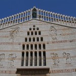
Entry is from the west, where signs indicate a route for visitors. On the cream limestone façade are reliefs of Mary, Gabriel and the four evangelists, Matthew, Mark, Luke and John. Above them is a bronze statue of Jesus.

Over a door on the southern side stands a statue of Mary aged 14, welcoming all who come to visit her home.


Grotto contains cave-home

Church of the Annunciation

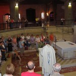
Eucharist in front of grotto in Church of the Annunciation (Seetheholyland.net)

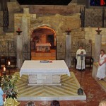
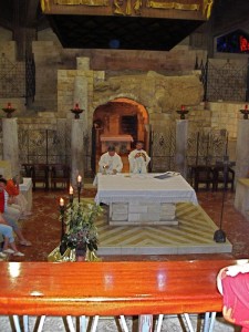
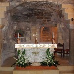
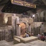
The lower level of the Church of the Annunciation enshrines a sunken grotto that contains the traditional cave-home of the Virgin Mary.

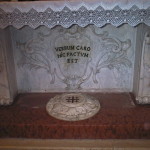
The cave is flanked by remnants of earlier churches on the site. Its entrance is sometimes closed by a protective grille. Inside the cave stands an altar with the Latin inscription “Here the Word was made flesh”.

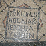
To the left of the cave entrance is a mosaic floor inscribed with the words “Gift of Conon, deacon of Jerusalem”.

The deacon may have been responsible for converting the house of Mary into the first church on the site, around 427.

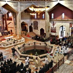
In front of the cave is another simple altar, with tiers of seats around it on three sides. Above it, a large octagonal opening is situated exactly under the cupola of the church.


Cupola represents a lily

The plan of two churches, one above the other and interconnected, was conceived by the Italian architect Giovanni Muzio.

As well as preserving the remains of previous churches on the lower level, he allowed for the risk of earthquake by constructing the building in three separate sections of reinforced concrete.

Church of the Annunciation

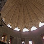
Dome of Church of the Annunciation (Seetheholyland.net)

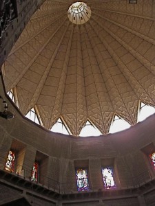
The soaring cupola represents an inverted lily opening its petals to the shrine below. The symbolism combines the lily, as an image of Mary’s purity, with one of the Semitic meanings of the name Nazareth, a flower.

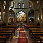
A spiral stairway at the main entrance leads to the large and spacious upper church. This is the parish church for the Catholic community of Nazareth (which is why the inscriptions on the ceramic Stations of the Cross are in Arabic).

The main entrance of the upper church is on the northern side, leading off a large elevated square overlooking the valley of Nazareth.

Around the walls of the upper church are colourful representations of the Virgin Mary in a variety of materials, presented by many countries.

Behind the main altar is a huge mosaic, one of the biggest in the world, depicting the “one, holy, catholic and apostolic church”.


Excavations revealed early shrine

The first church on the site venerated as Mary’s home was built around 427. The Crusaders built a huge basilica on its ruins, but this too was destroyed when the Crusader kingdom fell in 1187.

In 1620 the Franciscans managed to purchase the site from the local Arab ruler, but it was a further 120 years before they were allowed to build a new church.

When that church was demolished to prepare for the modern basilica, extensive excavations took place. These revealed the remains of the ancient village of Nazareth with its silos, cisterns and other cave-dwellings.

The most sensational discovery was of a shrine or synagogue-church dating back to before the first church was built. Scratched on the base of a column appeared the Greek characters XE MAPIA, translated as “Hail Mary” — the archangel Gabriel’s greeting to Mary.


First-century house

In December 2009 the Israel Antiquities Authority announced the discovery of a house from the time of Christ, on a property next to the Church of the Annunciation.

Nazareth

First-century Nazareth house discovered in 2009 (© Assaf Peretz / Israel Antiquities Authority)

The authority described it as “the very first” residential building found from the old Jewish village.

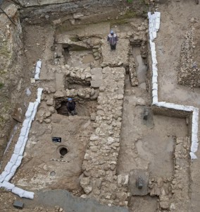
Small and modest, the house consisted of two rooms and a courtyard with a cistern to collect rainwater.

The remains of the house were found during an excavation prior to construction of the Mary of Nazareth International Center. They are conserved and displayed inside that building.

Other sites in Nazareth:

Nazareth

Church of St Joseph

Nazareth Village

In Scripture:

The Annunciation: Luke 1:26-38


Administered by: Franciscan Custody of the Holy Land

Tel.: 972-4-6572501

Open: 8am-6pm


References

Brownrigg, Ronald: Come, See the Place: A Pilgrim Guide to the Holy Land (Hodder and Stoughton, 1985)
Doyle, Stephen: The Pilgrim’s New Guide to the Holy Land (Liturgical Press, 1990)
Freeman-Grenville, G. S. P.: The Holy Land: A Pilgrim’s Guide to Israel, Jordan and the Sinai (Continuum Publishing, 1996)
Gonen, Rivka: Biblical Holy Places: An illustrated guide (Collier Macmillan, 1987)
Israel Antiquities Authority: “A Residential Building from the Time of Jesus was Exposed in the Heart of Nazareth”, media release, December 23, 2009
Joseph, Frederick: “Basilica of the Annunciation in Nazareth”, Holy Land, spring 2005
Kilgallen, John J.: A New Testament Guide to the Holy Land (Loyola Press, 1998)
Murphy-O’Connor, Jerome: The Holy Land: An Oxford
Archaeological Guide from Earliest Times to 1700 (Oxford University Press, 2005)
Walker, Peter: In the Steps of Jesus (Zondervan, 2006)
Wareham, Norman, and Gill, Jill: Every Pilgrim’s Guide to the Holy Land (Canterbury Press, 1996)


External links

Nazareth (Custodia Terrae Sanctae)
Basilica of Annunciation (BibleWalks)
Nazareth (Christus Rex)
Nazareth (Nazareth Cultural & Tourism Association)
Nazareth (Wikipedia)
Nazareth (Catholic Encyclopedia)
Church of St Joseph

Israel

Church of St Joseph

Church of St Joseph, Nazareth (Seetheholyland.net)

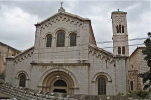
A fond tradition asserts that the Church of St Joseph in Nazareth is built over the carpentry workshop of the husband of the Virgin Mary.

The church (also known as the Church of the Nutrition and the Church of Joseph’s Workshop) is a solid and unpretentious building. It stands very much in the shadow of the soaring cupola of the Church of the Annunciation on its southern side — just as St Joseph himself lived in the shadow of Jesus and Mary.

But there is no evidence that the cave over which the church is built was Joseph’s workshop. Even if this is the site of the Holy Family’s home, the cave is unlikely to have been a carpentry workshop in the modern sense.

The Gospels use the Greek word tekton, meaning builder or artisan, to describe Joseph. He most likely worked with both stone and wood, since stone was the common building material in the area.

Joseph’s work may have taken him away from his home. A likely place of employment was the Roman city of Sepphoris or Tzippori, which was being rebuilt by Herod Antipas at the time the Holy Family arrived from Egypt. The building site was a 50-minute walk from Nazareth.


Cave system under church

Church of St Joseph

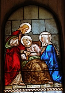
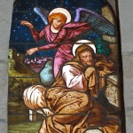
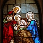
Death of St Joseph, stained glass in Church of St Joseph (Seetheholyland.net)

The Church of St Joseph was built in 1914 on the remains of a Crusader church and over a cave system. The first mention of the site occurs in the work of a 17th-century Italian writer and Orientalist, Franciscus Quaresmius, who described it as “the house and workshop of Joseph”.

The apse of the church has three noteworthy paintings: The Holy Family, The Dream of Joseph, and The Death of Joseph in the Arms of Jesus and Mary.

A stairway in the church descends to a crypt where caverns can be seen through a grille in the floor. Seven further steps lead to a 2-metre square basin or pit with a black-and-white mosaic floor. This is believed to have been a pre-Constantinian Christian baptistry, perhaps used as early as the 1st century.

Beside the basin, a flight of rough steps leads down to a narrow passage which, after turning 180 degrees, opens into an underground chamber 2 metres high.

Off this are openings to grain silos and water cisterns, cut into the soft limestone rock by early dwellers. Such underground repositories were typical of ancient Nazareth.

Other sites in Nazareth:

Nazareth

Church of the Annunciation

Nazareth Village

In Scripture:

Joseph takes Mary as his wife: Matthew 1:18-25

Administered by: Franciscan Custody of the Holy Land

Tel.: 972-4-6572501

Open: 8am-6pm


References

Brownrigg, Ronald: Come, See the Place: A Pilgrim Guide to the Holy Land (Hodder and Stoughton, 1985)
Doyle, Stephen: The Pilgrim’s New Guide to the Holy Land (Liturgical Press, 1990)
Freeman-Grenville, G. S. P.: The Holy Land: A Pilgrim’s Guide to Israel, Jordan and the Sinai (Continuum Publishing, 1996)
Gonen, Rivka: Biblical Holy Places: An illustrated guide (Collier Macmillan, 1987)
Joseph, Frederick: “Basilica of the Annunciation in Nazareth”, Holy Land, spring 2005
Kilgallen, John J.: A New Testament Guide to the Holy Land (Loyola Press, 1998)
Murphy-O’Connor, Jerome: The Holy Land: An Oxford Archaeological Guide from Earliest Times to 1700 (Oxford University Press, 2005)
Walker, Peter: In the Steps of Jesus (Zondervan, 2006)
Wareham, Norman, and Gill, Jill: Every Pilgrim’s Guide to the Holy Land (Canterbury Press, 1996)


External links

St. Joseph Church (BibleWalks)
Nazareth – Saint Joseph (Custodia Terrae Sanctae)
Nazareth (Wikipedia)
Nazareth (Catholic Encyclopedia)
All content © 2022, See the Holy Land | Site by Ravlich Consulting & Mustard Seed
You are welcome to promote site content and images through your own
website or blog, but please refer to our Terms of Service | Login